The United States is keeping a large amount of evidence of Vietnam’s sovereignty over Hoang Sa (Paracel) and Truong Sa (Spratly) archipelagos in the East Sea.
Part 1: The search for evidence of sovereignty over East Sea islands Part 2: The US’s evidence of Vietnam’s sovereignty over islands
The nation was the first place a team of Vietnamese scientists searched for historic materials in global libraries to prove Vietnam’s legal sovereignty over the islands.
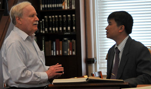
Thanks to the devoted support of a Vietnamese American scholar now living in Hawaii and Ms. Phan Thi Ngoc Chan, a librarian at the Harvard – Yenching Institute, the team was able to access archives of original documents related to the territorial disputes over Hoang Sa (Paracel) and Truong Sa (Spratly).
These include the Constans Treaty between France and China in 1887, a peace treaty with Japan in 1951, material on the wreck of the German Bellona ship in 1895 and Japanese Imeji Maru ship in 1896 in the waters near Hoang Sa, and documents on the Japanese occupation of the islands in the East Sea during World War II.
After leaving the Boston institute, the Vietnamese team flew to West Hartford, Connecticut to visit Mr. Tran Thang, a collector who has donated precious maps and documents to the Da Nang Institute for Socio-Economic Development (DISED).
Residing in the US since 1991, Thang graduated from University of Connecticut with a major in mechanics and currently works for airplane engine manufacturing company Pratt & Whitney. He has a passion for collecting antiques, including old maps and documents.
In 2012, he donated to the Da Nang institute 150 maps and three atlases, printed and published from 1618-1901 in the US and Europe. They include precious maps such as the “Asia Noviter delineate” drawn by Willem Blaeu in the Netherlands in 1618 and the “Indiæ Orienetalis Nova Descriptio” drawn by Willem Jansson in the Netherlands in 1636.
These maps show geographical links between Vietnam with Hoang Sa (Paracel) and Truong Sa (Spratly).
The team also visited institutes in Philadelphia and New York and the library of the US Congress in Washington DC to find historic materials and attend talks about maritime culture and business in Vietnam in the 17th and 18th centuries.
Thanks to the recommendation of researcher Nguyen Dinh Dau in Ho Chi Minh City, the team met Harold E. Meinheit, a former official of the US Department of State and a map researcher. He is a specialist on the ancient maps found in the US Congress library.
In the library, the team was overwhelmed by a collection of 170,000 maps, including 1,000 maps featuring Vietnam and its islands. Many maps they found refer to the sovereignty of Vietnam over Hoang Sa and Truong Sa, such as “The East part of India” and “The principal islands of the East India” drawn by Herman Moll in London in 1736, the “Asiae Nova Delineatio Auctore” by Nicolas Visscher in Amsterdam in 1681, and the “Hinterindien” by Sir Francis Halminton published in London and Calcutta in 1832.
All aforementioned maps show Vietnam’s sovereignty over Hoang Sa (Paracel) and Truong Sa (Spratly) archipelagos in the East Sea.
Mr. Meinheit said it takes a researcher at least a year to study all of the maps related to Vietnam, Hoang Sa, and Truong Sa in the library.
Special maps in the Netherlands
The Vietnamese team left the US for the Netherlands to consult with respected officials of the nation about the disputed islands and the East Sea. These officials are PhD W.F. van Eekelen, former defense minister of the Netherlands; PhD Koetsier, international public law expert of Amsterdam University; and PhD Frans-Paul Van Der Putten, an expert on East Asian affairs of the Netherlands Institute of International Relations Clingendael.
Mr. Eekelen invited the team to his home in a suburb of The Hague, where he showed them several maps he collected that feature Hoang Sa and Truong Sa of Vietnam.
“Vietnam has an abundance of historical evidence of its sovereignty over Hoang Sa and Truong Sa,” he confirmed and advised that, “But the best way to defend the right is to refer to the United Nations Convention on the Law of the Sea (UNCLOS) 1982, the International Tribunal for the Law of the Sea, and the International Court of Justice.”
He also recommended that the team visits the National Archives of the Netherlands to review more maps featuring the sovereignty of Vietnam over Hoang Sa (Paracel) and Truong Sa (Spratly) archipelagos.
They include three maps drawn on pieces of goat skin by navigator Joan Blaeu in 1687. Here, the team viewed many letters and other documents exchanged between Dutch traders and the King of Vietnam in the 17th century for the rights to access the islands.
The team even obtained a copy of the map “Nova et Exacta Asiæ Geographica Descriptio” drawn by G.Ianßonio in the 17th century.


