China brainwashes students with false textbook content regarding East Vietnam Sea sovereignty
Tuesday, June 17, 2014, 19:37 GMT+7

The Chinese government has incorporated false and unreasonable content into school textbooks in order to propagandize their groundless sovereignty over the East Vietnam Sea.
An absurd claim on China’s southernmost point has been written in some Chinese textbooks Tuoi Tre (Youth) newspaper has found.
It says that China’s southernmost point is located at the James Shoal, 80km northwest from Malaysia, at 4 degrees north latitude. In reality, that point is Hainan Island.
The South China Sea [the Chinese name for the East Vietnam Sea] on the maps of almost all geography textbooks for middle and high schools in China is determined by the “cow tongue line,” also called the nine-dotted line or U-shaped line created by China to claim sovereignty over nearly the entire sea, including Vietnam’s Hoang Sa (Paracel) and Truong Sa (Spratly) archipelagoes.
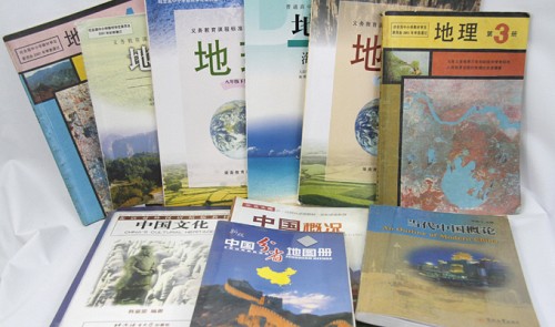
Middle and high school education
Specifically, information found on page 2 and 3 in volume 3 of the middle school geography textbook series published by the Ren Min Jiao Yu Publisher (reprinted in 2005) claims that China’s southernmost point is the James Shoal.
According to the book, China’s coastline is over 18,000 km long and the country owns over 5,000 islands in the East Vietnam Sea. Moreover, it claims that China’s territory stretches nearly 50 latitudes from its southernmost point to its northernmost point.
With such content, China has claimed the East Vietnam Sea as its own and conveyed a wrong and unreasonable message to the country’s young generations.
A former student in Beijing told Tuoi Tre that the positions of the four directions of north, west, east, and south is an important part of the high school curriculum in China and is always emphasized by teachers in class.
“This is something every Chinese student learns. I remember that because the maps in my textbooks repeated it over and over,” he said.
He then mentioned a map in which China’s territory stretches from the northern Chinese province of Heilongjiang, passing through the southern island of Hainan, and includes the nine-dotted line that covers Vietnam’s Paracel and Spratly archipelagoes and areas 80km away from Malaysia.
Moreover, on page 4 of volume 1 of the 8th grade geography textbook series published by Hunan Education Publisher (reprinted in 2011), China claims to be a strong country and also to have one of the longest coastlines in the world.
Along with arbitrarily expanding their territory, China has also eyed natural resources in the East Vietnam Sea.
Page 91 in volume 3 of the middle school geography textbook series published by the Ren Min Jiao Yu Publisher blatantly affirms that China discovered the oilfields in the East Vietnam Sea and is drilling for oil in the area.
A photo illustrates that China is targeting the Spratly archipelago, which is believed to contain a huge amount of oil.
Meanwhile, a map on page 9 in volume 4 of the middle school geography textbook series published by the above publisher (and reprinted in 2004) also underlines that the East Vietnam Sea house the largest fishing area of the waters China believes it has sovereignty over.
Similarly, a reading test in volume 1 of the same publisher’s 8th grade geography textbook series (republished in 2011) includes information that posits “the South China Sea [East Vietnam Sea] does not only have the largest number of fisheries and oilfields but also the highest amount of fish and oil in China.”
Paracel and Spratly archipelagos
In addition, China has also attempted to turn Vietnam’s Paracel and Spratly archipelagoes into its own territory. Page 84 of the marine geography book in the high school textbook series published by the Ren Min Jiao Yu Publisher (reprinted for the 18th time in 2011) describes the Spratly archipelago as follows:
“The Nansha [Spratly] archipelago is an island located in the south of the South China Sea. China has indisputable sovereignty over the Nansha archipelago and the surrounding islands. This is based on a historical and legal basis. Historical truth shows that the Nansha archipelago is part of China’s territory. China is the first country to discover, name and exploit the islands, as well as the first country to claim sovereignty over them.”
Page 66 in volume 2 of the Hunan Education Publisher’s 8th grade geography textbook (reprinted in 2011) also contains information about “the Xisha archipelago” (Vietnam’s Paracel archipelago).
As described in the book, the archipelago is one of the four biggest islands in the East Vietnam Sea. China has also propagandized that Beijing had put an administrative center on the 1.68-square-meter Yongxing Island (Vietnam’s Phu Lam Island).
The book also describes “the Xisha islands” as an area with a hot and humid climate, beautiful landscapes, and one of the most important fisheries in the East Vietnam Sea.
The Chinese students and former students Tuoi Tre has talked with believe that the Paracel and Spratly archipelagoes belong to China because that is what they have been taught since they were children.
“It’s an undeniable truth. For ages, Xisha and Nansha (Paracel and Spratly) have belonged to China. We learned this when we were little,” a student from a university in Quangdong Province said.
What foreign students have been taught
China’s baseless claim on the East Vietnam Sea has not only been systemized in the high school curriculum, but also mentioned in books for foreign students studying in the country, making them completely misunderstand the issue.
Most foreign students in China have to study a subject which gives an overview of Chinese geography, history, and culture.
Page 2 and 3 of the book “An Outline of Modern China” for master’s students published by Jinan University Press (reprinted in 2008) says China’s southernmost point is the James Shoal.
A similar affirmation is also made in the book “Chinese Culture” published by Beijing Language and Culture University Press (reprinted in 2006).
Moreover, page 1 and 2 of the textbook on China for foreign students published by Peking University Press (reprinted in 2007) claims that the East Vietnam Sea and thousands of islands are one of the four sea areas that China believes it is entitled to.
According to some Vietnamese students in Beijing, Chinese teachers often avoid explaining clearly the “cow tongue line” or the Paracel and Spratly archipelagos, especially when the class has Vietnamese or Filipino students.
Many Vietnamese students have expressed their indignation at the blatant fabrications of China.
“If we do not write that China’s southernmost point is the James Shoal in the final test, our score will be deducted,” a Vietnamese student studying in Quangxi said. “But if we choose an answer that China’s southernmost tip is the James Shoal, we will indirectly support their false claims.”
He also shared that may of his friends refused to answer the question on the southernmost point or other questions which aim to “trap” Vietnamese students into acknowledging China’s unfounded sovereignty claim.
Also according to him, the lack of a clear understanding of the sovereignty issue between Vietnam and China has led to many Vietnamese students in China failing to oppose what they are taught at school.
“While the awareness of the Paracel and Spratly archipelagos has been inveterate with almost all Chinese students, Vietnamese students seem not to have a proper understanding of the islands. That is dangerous,” he said.
Students from other countries also feel dismayed at China’s sovereignty claims.
A student from the Middle East complained that he feels it is unreasonable as China announces its sovereignty over the waters that are not only far away from Hainan Island but also encroach upon other countries.
“I don’t understand the dispute between the countries. But I see it’s unreasonable when I look at the map,” he said. However, when asked about China’s southernmost point, he still answered that it was the James Shoal.
“That’s what we have learned, and it’s hard to change. You only study it further when you have a strong interest in the sea issue. In China, the Internet has been strictly controlled, so it’s difficult to get mixed opinions,” an Indian student expressed.

The Vietnam Directorate of Market Surveillance has launched a large-scale inspection into gold shops in various localities

A student at a major college in Ho Chi Minh City has spent months creating an English-teaching robot, and went on to think of a futuristic school where all teachers are robots shortly after his efforts yielded success.
5 years ago

She developed symptoms of hard, wavy, scaly, gray skin, mainly on her wrists, elbows, knees, ankles, armpits, back of hands, and insteps, as well as full-body dry skin


He drew the virus, vaccine, and earth on the exterior walls of a house

She developed symptoms of hard, wavy, scaly, gray skin, mainly on her wrists, elbows, knees, ankles, armpits, back of hands, and insteps, as well as full-body dry skin

President Diaz-Canel remarked that the Cuba-Vietnam relations are special, with both nations always showing great respect for each other

Masuo Ono, Japanese Consul General in Ho Chi Minh City, affirmed that the support from local authorities and the partnership between Vietnamese and Japanese firms will contribute to sustainable development in the province

Passengers were warned not to come to Dubai airport, the world's busiest by international traffic, 'unless absolutely necessary'

Agricultural products remain Vietnam’s key export earner

Australian Assistant Minister for Climate Change and Energy Jenny McAllister made the announcement while addressing the Australia-Vietnam Green Economy Summit that opened on April 16 in Ho Chi Minh City, attracting some 200 businesses, investors, and experts from the two countries

Many delivery workers are spotted using their phones while driving, posing a high risk of traffic crashes

Both nations previously launched the Australia-Vietnam Green Economy Program to foster collaboration between government and business in the green economy

The European Union and the governments of 13 countries urged nations on Tuesday to prioritise the ratification of a U.N. treaty to protect the world's oceans from overfishing and other human activities

These shows will last 15 minutes from 9:00 pm to 9:15 pm on April 30


