Increasing land erosion plagues Vietnam’s Mekong Delta
Wednesday, June 20, 2018, 20:33 GMT+7

Coastal and riverine areas in Vietnam’s Mekong Delta have witnessed worryingly rapid land erosion during the past several years, owing to loss of alluvium in the Mekong River, heralding a grim scenario for the region’s livelihood.
About 25 years since 1992, the southern Vietnam’s Mekong Delta, home to over 20 million people, witnessed increasing land erosion and declining alluvial deposition, with the first occurrence evolving at a much higher rate than the second in several areas, according to Nguyen Huu Thien – an independent ecological expert.
This spelt the end of a six-millennium period in which accumulation of alluvium invariably dominated erosion in the Mekong basin of Vietnam, expanding the area continuously, Thien said.
From 2005 onwards, more than half of the region’s coastline has recorded erosion, which is also seen along local rivers, large and small, Thien said.
Up to 50 meters of coastal land was averagely worn away every year in some locations, the researcher added.
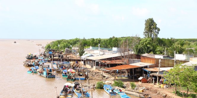 |
| Boats and riverine houses are seen in Vietnam’s Mekong Delta. Photo: Tuoi Tre |
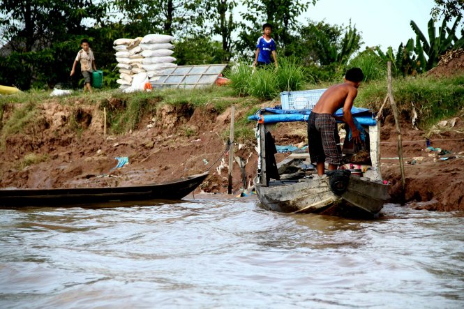
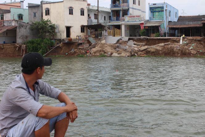 |
| A man looks at an eroded road from a boat in An Giang Province, Vietnam. Photo: Tuoi Tre |
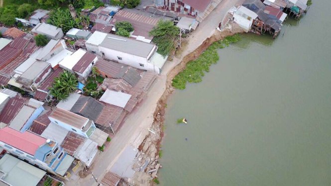
During the past two months, a series of land erosions on river banks played out in the Mekong Delta’s provinces of Tien Giang and An Giang, and Can Tho – the region’s largest and most modern city, sending multiple residents into homelessness and confusion as their house were toppled and washed away.
Vietnam’s southernmost province of Ca Mau, which faces the sea on three sides, has sustained the greatest damage from the erosion, with its coastal protective forests and embankments succumbing to destructive waves, and locals forced to evacuate.
Averagely 20-25 meters of Ca Mau’s coastal land is eaten away yearly, and around 8,900 hectares of the seashore for protected forests has disappeared during the past 11 years.
Hundreds of thousands of households in these places lost their property and experienced a threat to their lives and sources of income, which rely chiefly on farming.
Near the province’s Vam Xoay Estuary – a local infamous erosion hotspot, from which a number of residents have fled, those trying to stay are living with a constant worry.
The Mekong Delta, Vietnam’s rice and fruit basket, is currently dotted with 562 land erosion spots collectively stretching 786 kilometers along the coastline and rivers, according to an online subsidence map released by Vietnam’s agriculture ministry recently.
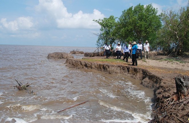 |
| Officials observe an eroded area in Ca Mau Province, Vietnam. Photo: Tuoi Tre |
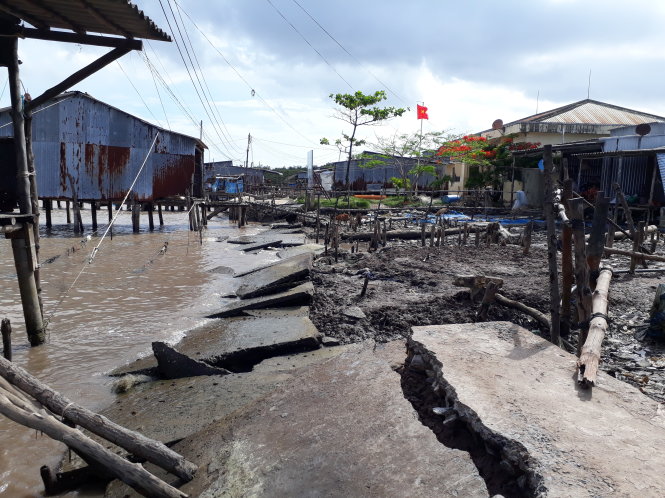 |
| Concrete slabs fall apart due to erosion at the Vam Xoay Estuary in Ca Mau Province, Vietnam. Photo: Tuoi Tre |
Amongst them, 55 locations are gravely dangerous, reaching the length of 173 kilometers.
Thien put the extensive erosion primarily down to the lack of alluvium in the Mekong system.
The insufficiency stems from hydroelectricity dams recently built upstream across the Mekong River, and the inland sand mining in countries crossed by the river, especially in Cambodia and Vietnam.
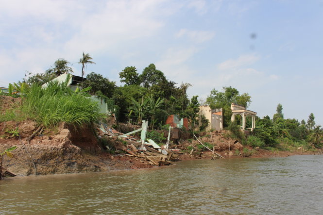 |
| A house has collapsed near a river sand extraction in Dong Thap Province, Vietnam. Photo: Tuoi Tre |
 |
| A man anchors his boat at an eroded river bank in An Giang Province, Vietnam. Photo: Tuoi Tre |
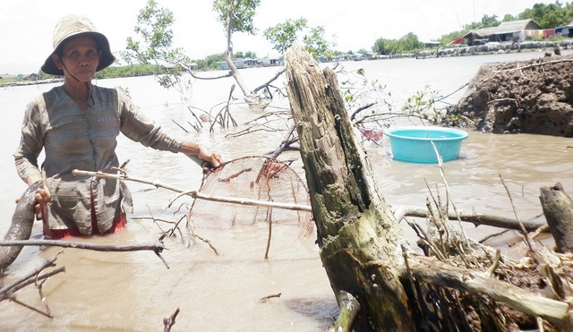 |
| A woman poses for photos while catching fish in Ca Mau Province, Vietnam. Photo: Tuoi Tre |
Like us on Facebook or follow us on Twitter to get the latest news about Vietnam!

Widespread stick-on ads are a headache for not only Da Nang City but also other major cities in Vietnam

A striking McLaren 750S Spider, resplendent in a vibrant orange hue, took center stage at its debut ceremony held in Ho Chi Minh City
1 day ago
The US$/VND exchange rate has been on an upward trajectory in recent days
12 hours ago
Incoming remittances to Ho Chi Minh City reached nearly US$2.9 billion in the first quarter this year
2 days ago
The Vietnam Directorate of Market Surveillance has launched a large-scale inspection into gold shops in various localities
4 days ago
The expansion will bring the total number of FPT Retail’s pharmacies to 1,900
2 days ago
The music video was filmed at Hanoi’s renowned heritage sites


He drew the virus, vaccine, and earth on the exterior walls of a house

The initiative is expected to yield indirect revenues of around $15-16 billion for the economy

Vietnam and Venezuela established diplomatic relations in 1989 and the two nations entered a comprehensive partnership in 2007

The music video was filmed at Hanoi’s renowned heritage sites

One victim was in critical condition and the others were in stable condition

The IMF was working to reinforce its ability to support low-income countries hit hardest by recent shocks

The land subsidence continued to ravage a road adjacent to the warehouse, causing road cracks on an area of 168 square meters

Tesla is recalling 3,878 Cybertruck vehicles because of the defect

The two tourists both broke their left legs

They disguised drugs among other goods

Residents have found it hard to sell fresh chilies due to the low prices and traders’ refusal


