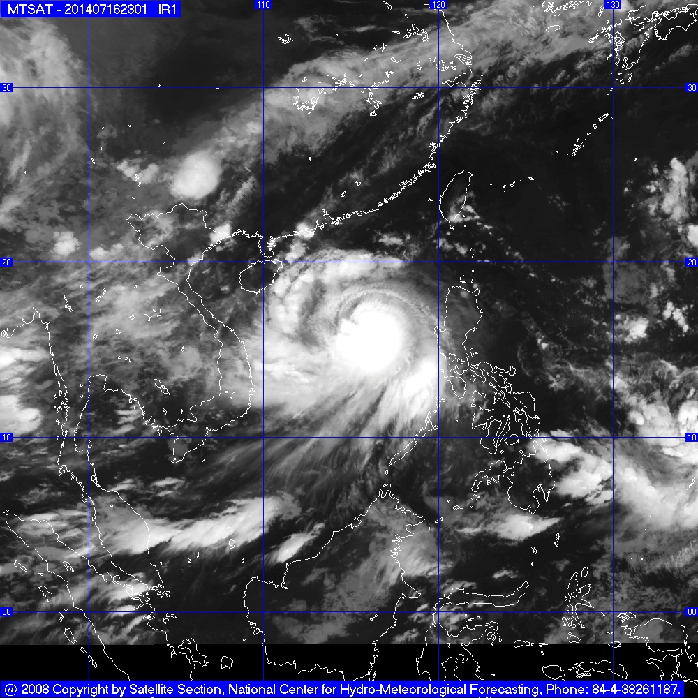
After passing through China’s Hainan Island on Saturday morning, powerful tropical storm Rammasun will enter the Gulf of Tonkin and head for Vietnam’s northern coastal Quang Ninh-Hai Phong area, Vietnam’s national weather agency has said.
>> Rammasun to go past Vietnam’s Hoang Sa Islands before heading for China >> Powerful typhoon Rammasun to head for Vietnam’s Hoang Sa Islands >> Storm to enter East Sea, bringing widespread rain to Vietnam
The super typhoon entered the East Vietnam Sea yesterday afternoon after it hit the Philippines, forcing an evacuation of 370,000 people and leaving at least 27 dead, the Vietnam National Hydro-Meteorological Forecasting Center said. At 7:00 am this morning (Vietnam time), the storm was centered about 390 km east-southeast of Vietnam’s Hoang Sa (Paracel) archipelago, packing sustained winds of 118-149 kph and gusts of up to 201 kph. The storm is moving west-northwest and northwest at a speed of 20-25 kph and is forecast to be seen 200 km north off Hoang Sa at 7:00 am on Friday, with maximum winds of 166 kph and squalls of 202-220 kph. The typhoon will move in the same direction but with a lower speed of about 20 kph, heading for the Gulf of Tonkin. At 7:00 am on Saturday, July 19, the storm will be centered off the coastal area from northern Quang Ninh to Thai Binh Provinces, packing maximum winds of 133 kph in the storm’s eye, along with gusts of 150-183 kph. Typhoon Rammasun will then move toward the coastal area between Quang Ninh Province and Hai Phong City, with winds of up to 201 kph, and will likely hit the area later the same day. “It is forecast that the super typhoon will strike the Quang Ninh-Hai Phong area some time between the morning and afternoon of Saturday [July 19],” said Hoang Duc Cuong, director of the Vietnam National Hydro-Meteorological Forecasting Center. The storm will bring heavy rain to northern Vietnam, with rainfall measuring at 200-300 mm, he said. Due to the storm, the north and central area of the East Vietnam Sea is experiencing rough waters and winds of 75-117 km, which will increase to 149 kph in areas near the storm’s eye, together with gusts of up to 201 kph. The waters of Hoang Sa are also rough, experiencing maximum winds of 166 kph and squalls of up to 201 kph. Sea waves there have been recorded to be as high as 5-6 meters. Minister of Agriculture and Rural Development Cao Duc Phat, who is head of the Central Steering Board for Flood and Storm Prevention and Control, has asked local authorities in northern localities to request that all ships at sea go ashore as soon as possible to avoid the coming typhoon.
Like us on Facebook or follow us on Twitter to get the latest news about Vietnam!


