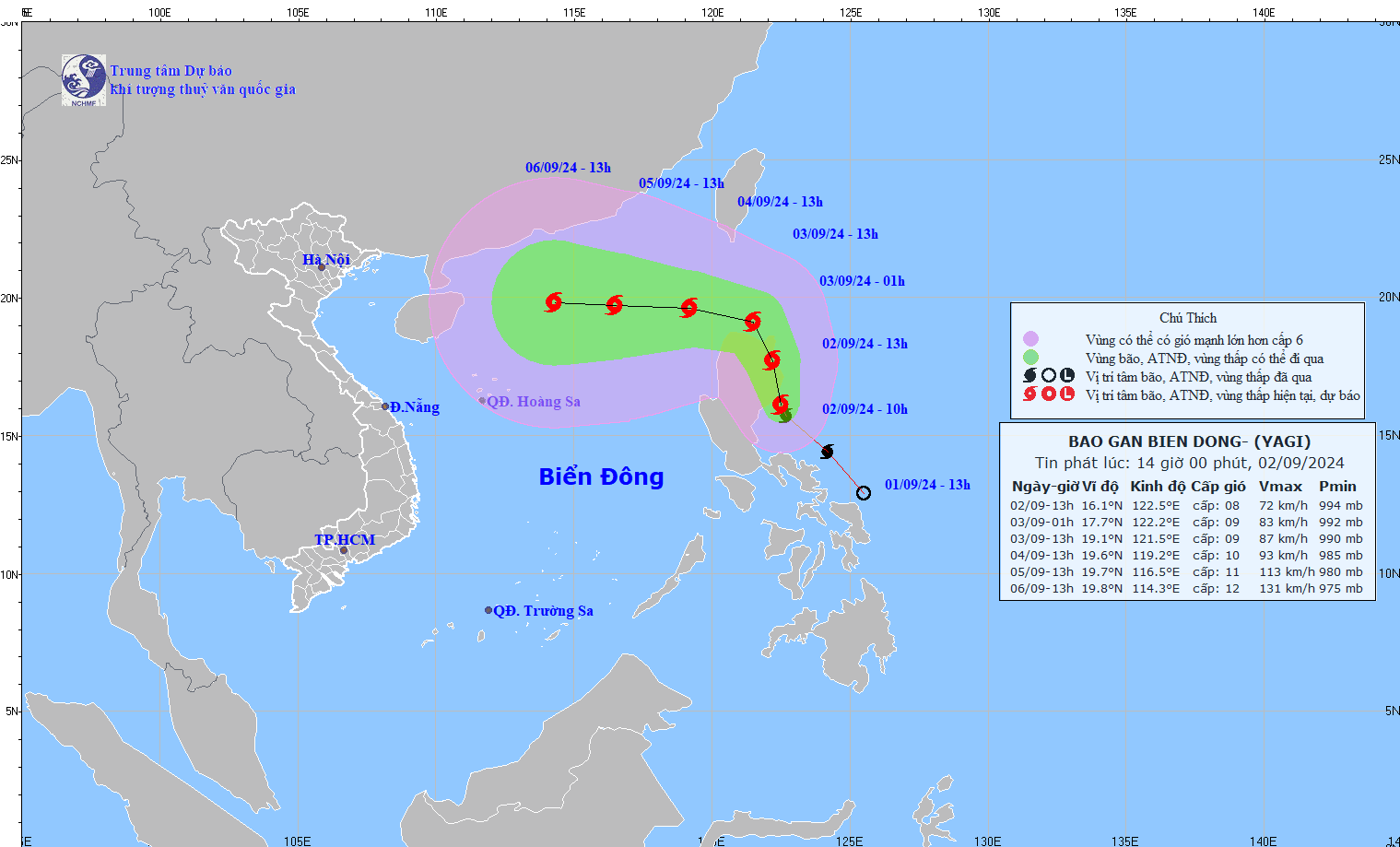
A powerful tropical storm, known internationally as Yagi, which is moving north-northwest in the waters east of the Philippines’ Luzon Island, may change its direction to move toward and reach the East Vietnam Sea by Tuesday evening, Vietnam’s central weather agency forecast.
At 1:00 pm on Monday, the Yagi was centered in the waters east of Luzon Island, packing sustained winds of up to 74 kph and gusts reaching 103-117 kph, the National Center for Hydro-Meteorological Forecasting reported.
The tropical storm is moving north-northwest at 20 kph and during the next 24 hours, it will probably change its direction to west-northwest and get stronger while moving at the same speed.
At 10:00 am on Tuesday, the storm will have been located in the waters northeast of Luzon Island, with winds reaching 88 kph and squalls of over 133 kph.
It will then continue changing its course to move west at about 10 kph and enter the East Vietnam Sea on the afternoon or evening of the same day.
The storm is expected to close in on the northern part of the East Vietnam Sea at 10:00 am on Wednesday, with winds strengthened to 102 kph and gusts of 134-149 kph.
Storm Yagi will later continue moving west at a velocity of about 15 kph, packing more powerful winds and squalls.
The northern region of the East Vietnam Sea is facing rough seas due to the storm, with waves ranging from two to four meters and winds reaching up to 74 kph, accompanied by squalls exceeding 117 kph since Tuesday afternoon, according to warnings from the center.
From Wednesday through Friday, storm Yagi is expected to intensify significantly, with gusts near its eye potentially reaching up to 183 kph.
During this time, the seas in the northern part of the East Vietnam Sea will become extremely turbulent, with waves as high as seven meters, creating highly dangerous conditions for vessels, the center cautioned.
Like us on Facebook or follow us on X to get the latest news about Vietnam!


