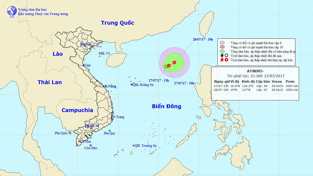
A depression forming in the East Vietnam Sea is expected to evolve into a storm as it picks up strength en route toward Taiwan and mainland China.
The low-pressure system was located some 470 kilometers northeast of Vietnam’s Hoang Sa (Paracel) archipelago on Thursday night, packing winds at 40 to 50km per hour and squalls at 60 to 70km an hour, the National Center for Hydro-meteorological Forecasting reported.
The tropical depression is forecast to move 570 kilometers southeast of Hoang Sa on Friday night as it creeps northeast at five km per hour with projected winds at between 40 and 60km an hour and squalls at up to 88km per hour.
According to Tran Quang Nang, an official from the National Center for Hydro-meteorological Forecasting, the tropical depression has, so far, mainly affected weather patterns at sea.
Rain and strong winds are expected in the areas in the northern part of the East Vietnam Sea and the maritime region stretching from the south-central province of Binh Thuan to the Mekong Delta province of Ca Mau.
Over the next couple of days, a heatwave will smother provinces in northern Vietnam with temperatures from 33 to 36 degrees Celsius, Nang said.
Meanwhile, rain will continue to fall in the Central Highlands and southern regions, mostly during evenings and nights, the weather pundit added.
Like us on Facebook or follow us on Twitter to get the latest news about Vietnam!


