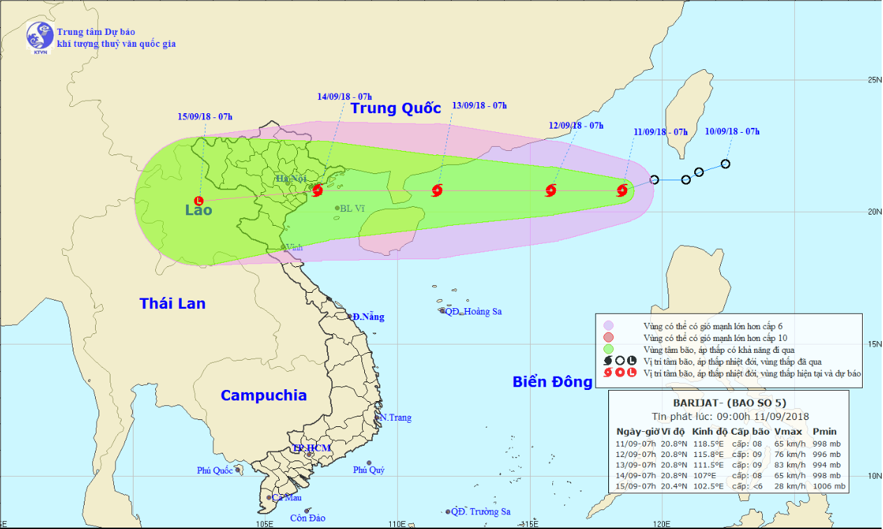
A tropical depression has evolved into a storm as it entered the East Vietnam Sea on Monday, while the powerful Typhoon Mangkhut in the Pacific Ocean is also on its course toward the maritime area.
The low-pressure system passed southern Taiwan before entering the East Vietnam Sea on Monday night, according to the National Center for Hydro-meteorological Forecasting.
It gathered enough strength to become a tropical storm, named Barijat, on Tuesday morning. This is the fifth storm to hit Vietnam this year.
As of 7:00 am, the storm was located 850 kilometers northeast of China’s Hainan Island, packing winds at 60 to 75km per hour and gusts at up to 100km an hour.
It was forecast to travel westward at 15km per hour in the next 24 hours and located 440 kilometers northeast of Hainan at 7:00 am on Wednesday.
Average wind speed will reach up to 90km per hour. The storm will continue picking up strength on its westward journey.
As of 7:00 am on Friday, Barijat will reach the coast between the northern Vietnamese province of Quang Ninh and the north-central province of Thanh Hoa.
Under the influence of the storm, rough sea, strong waves, and heavy rain will occur in the northern part of the East Vietnam Sea.
Meanwhile, Typhoon Mangkhut in the northwest part of the Pacific Ocean has been forecast to reach a super typhoon level, which packs winds at more than 213km per hour.
Over the next four days, Mangkhut is expected to head toward the East Vietnam Sea.
Like us on Facebook or follow us on Twitter to get the latest news about Vietnam!


