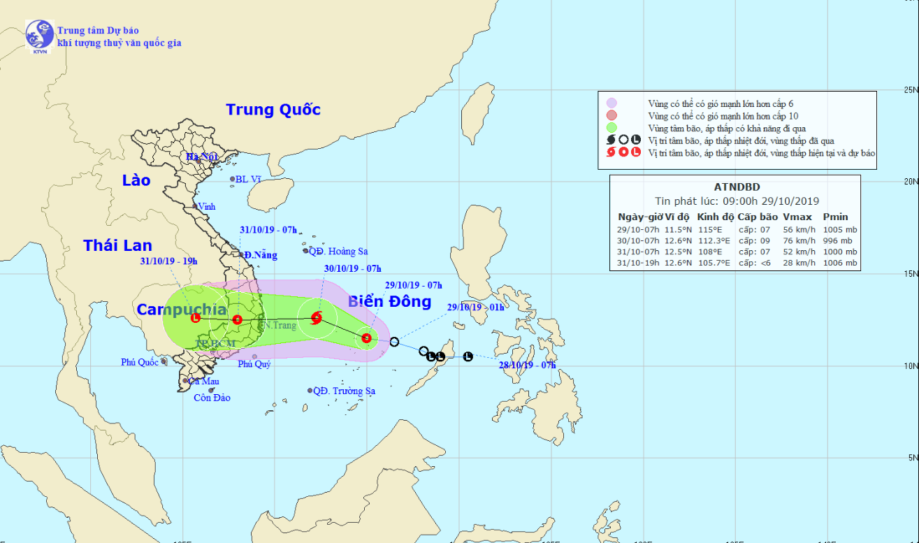
A tropical depression in the East Vietnam Sea is expected to evolve into a storm over the next day and cause massive rain in the central provinces and Central Highlands region of Vietnam.
The low-pressure system was located 140 kilometers east of Song Tu Tay Island, part of Vietnam's Truong Sa (Spratly) archipelago, as of 7:00 am on Tuesday, according to the National Center for Hydro-meteorological Forecasting.
Average wind speed was about 50 to 60 kilometers per hour, while gusts reached up to 75km an hour.
It is forecast to travel northwest in the next 24 hours and pick up enough strength to develop into a tropical storm.
The storm will be located approximately 300 kilometers east of the coastline between Phu Yen and Khanh Hoa Provinces in south-central Vietnam, unleashing winds at 60 to 90km per hour and gusts at 88km an hour.
It is likely to make landfall on the south-central coast in the next 24 to 48 hours, before weakening into a tropical depression.
Due to the weather phenomenon, extreme downpours will dampen localities along the central and south-central coast between Thua Thien-Hue and Ninh Thuan Provinces, as well as in the Central Highlands region on Wednesday and Thursday, with average rainfall estimated at 300-400 millimeters.
In such provinces as Binh Dinh, Phu Yen, and Khanh Hoa, rainfall may reach up to 600 millimeters.
From October 31 to November 2, rain will slightly decrease in intensity but still remain high at 200 to 300 millimeters.
Heavy downpours are expected to spread to southern provinces on November 4 and 5.
Like us on Facebook or follow us on Twitter to get the latest news about Vietnam!


