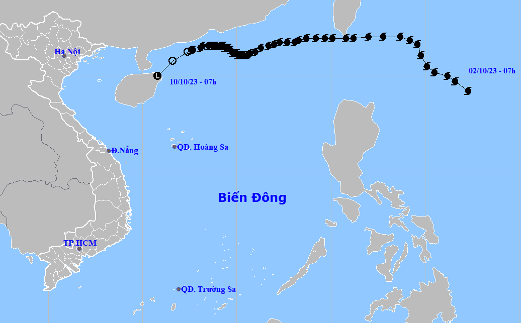
Typhoon Koinu, the fourth storm to hit Vietnam this year, weakened into a tropical depression and then a low pressure area in China’s Hainan Island early on Tuesday morning, said the Vietnamese national weather agency, adding that some central Vietnamese provinces could experience heavy rains in the next few days.
The low pressure area was centered in Hainan Island, packing winds blowing at below 39 kilometers per hour as of 7:00 am on Tuesday.
It is forecast to move southwest over the next 12 hours before weakening further and dissipating, according to the National Center for Hydro-Meteorological Forecasting.
Given the impact of Koinu, the Gulf of Tonkin and the northern waters of the East Vietnam Sea will likely see strong winds and rough seas throughout Tuesday.
Scattered showers and thunderstorms, accompanied by possible whirlwinds and gusts, are expected to hit the waters from central Quang Tri Province to southern Ca Mau Province during Tuesday.
Some central Vietnamese localities from Ha Tinh Province to Da Nang City could see moderate to heavy rains, with rainfall exceeding 150mm in several locations from Tuesday afternoon to Wednesday night, according to the national weather center.
Meanwhile, intense rainfall of over 300mm is forecast in areas from Ha Tinh to Quang Tri Province.
Heavy rains will likely spread to Nghe An Province, central Vietnam on Wednesday evening.
Downpours could last until this weekend in localities from Nghe An to Thua Thien Hue Province and may hit other provinces and cities in the northern delta from Wednesday night.
Authorities and local people should stay prepared for possible flash floods, landslides in mountainous regions and flooding in low-lying and urban areas, the center said.
Like us on Facebook or follow us on Twitter to get the latest news about Vietnam!


