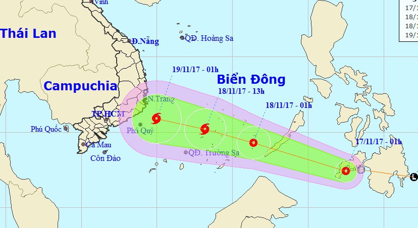
A tropical depression closing in on the East Vietnam Sea is forecast to strengthen into a storm.
According to the National Center for Hydro-meteorological Forecasting, a low-pressure zone developed into a tropical depression on Thursday night.
By Friday morning, it was located 470 kilometers southeast of the Philippines’ Palawan Island, packing winds at 40 to 50km per hour.
The tropical depression is expected to travel northwestward at a velocity of 30km an hour, picking up strength along the way.
By 1:00 am on Saturday the depression will reach 330 kilometers southeast of Song Tu Tay Island in the Truong Sa (Spratly) Archipelago in the East Vietnam Sea with wind speeds of 50 and 60km an hour.
Rains and rough seas are expected in the middle and southern areas of the East Vietnam Sea.
Meteorologists anticipate that over the next 24 to 48 hours the tropical depression will continue its northeast route at 25 to 30km per hour before strengthening into a typhoon.
According to Ho Chi Minh City-based weather pundit Le Thi Xuan Lan, the storm may affect provinces in south-central Vietnam.
However, the typhoon could potentially be weakened by a cold front approaching from the north, Lan added.
Like us on Facebook or follow us on Twitter to get the latest news about Vietnam!


