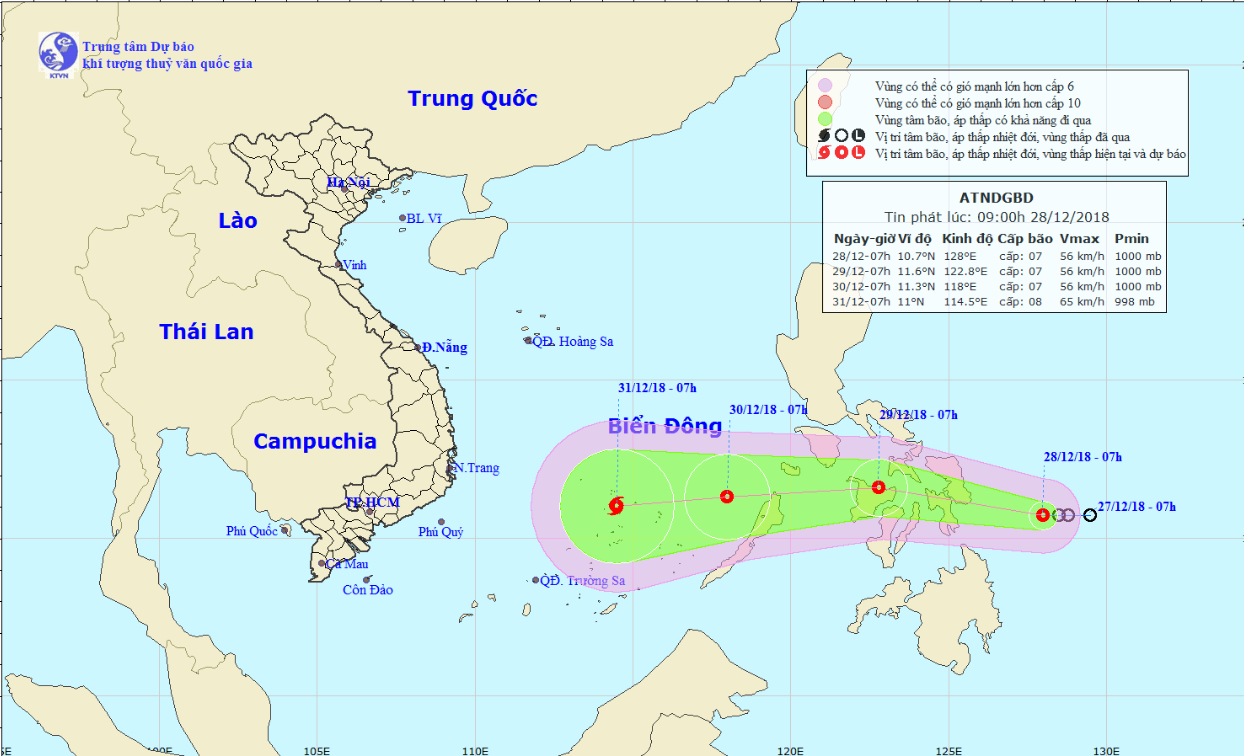
A tropical depression near the Philippines is forecast to gather strength and upgrade to a storm as it heads toward the East Vietnam Sea, according to the National Center for Hydro-meteorological Forecasting.
The low-pressure system was located about 290 kilometers southeast of the Philippines’ central coast at 7:00 am on Friday, unleashing winds of 50 to 60km per hour and gusts of 88km an hour.
Over the next 24 hours, it is expected to travel westward at an average speed of 20km per hour and should hit the central Philippine islands by 7:00 am Saturday.
The tropical depression is expected to continue heading west over the next 24 to 48 hours as it gathers strength en route to the East Vietnam Sea.
By 7:00 am on Sunday it will have been 420 kilometers east of Song Tu Tay Island, part of Vietnam's Truong Sa (Spratly) archipelago.
Meteorologists believe the depression could gather enough strength to evolve into a storm.
By 7:00 am on Monday, the storm is forecast to sit right above Song Tu Tay Island, battering the area with winds of 60 to 75km per hour and squalls of up to 100km an hour.
Under the combined effect of the tropical depression and a cold spell from the north, rough seas and strong waves are expected to occur in the central section of the East Vietnam Sea.
Vietnam has been struck by a total of nine storms since the beginning of the year.
The most recent one, Storm Usagi, impacted the south-central and southern regions in late November.
Despite weakening into a tropical depression, it still caused extreme downpours and large-scale flooding across many localities, including Ho Chi Minh City.
Like us on Facebook or follow us on Twitter to get the latest news about Vietnam!


