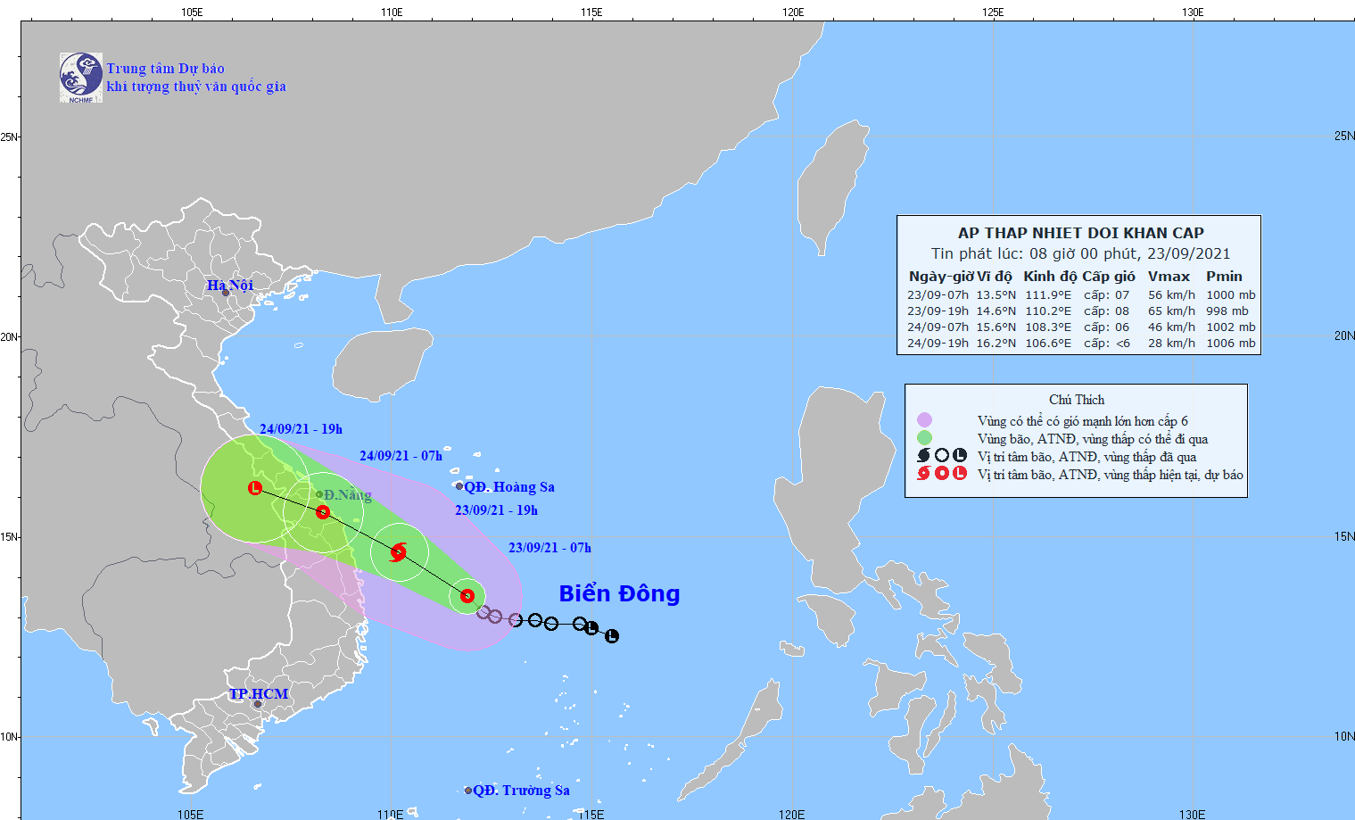
A tropical depression has formed in the East Vietnam Sea and is likely to evolve into a storm as it heads toward central provinces.
The low-pressure system was located 280 kilometers off the south-central province of Phu Yen at 7:00 am on Thursday, with winds at 50-60km per hour, according to the National Center for Hydro-meteorological Forecasting.
It is expected to travel northwest and evolve into a storm over the next 12 hours.
By 7:00 pm on Thursday, it will have moved within 130 kilometers off the south-central province of Binh Dinh, carrying wind speeds of 60-75km an hour.
The storm will make landfall over the next 12 to 24 hours in the localities between Thua Thien-Hue and Binh Dinh Provinces before weakening into a tropical depression.
Heavy downpours of 150-250 millimeters are forecast to batter the coast from Ha Tinh to Binh Dinh, as well as some provinces in the Central Highlands, on Thursday and Friday.
On Friday and Saturday, rainfall of 50-150 millimeters will dampen the north-central provinces of Thanh Hoa and Nghe An.
The weather pattern will pose risk of flash floods, landslides, and inundation in certain areas.
All boats in the affected areas have been advised to take shelter as rough seas will also occur during this period.
Like us on Facebook or follow us on Twitter to get the latest news about Vietnam!


