The combined effect of Typhoon Rai and a cold front is forecast to cause downpours in multiple provinces in central Vietnam starting Sunday.
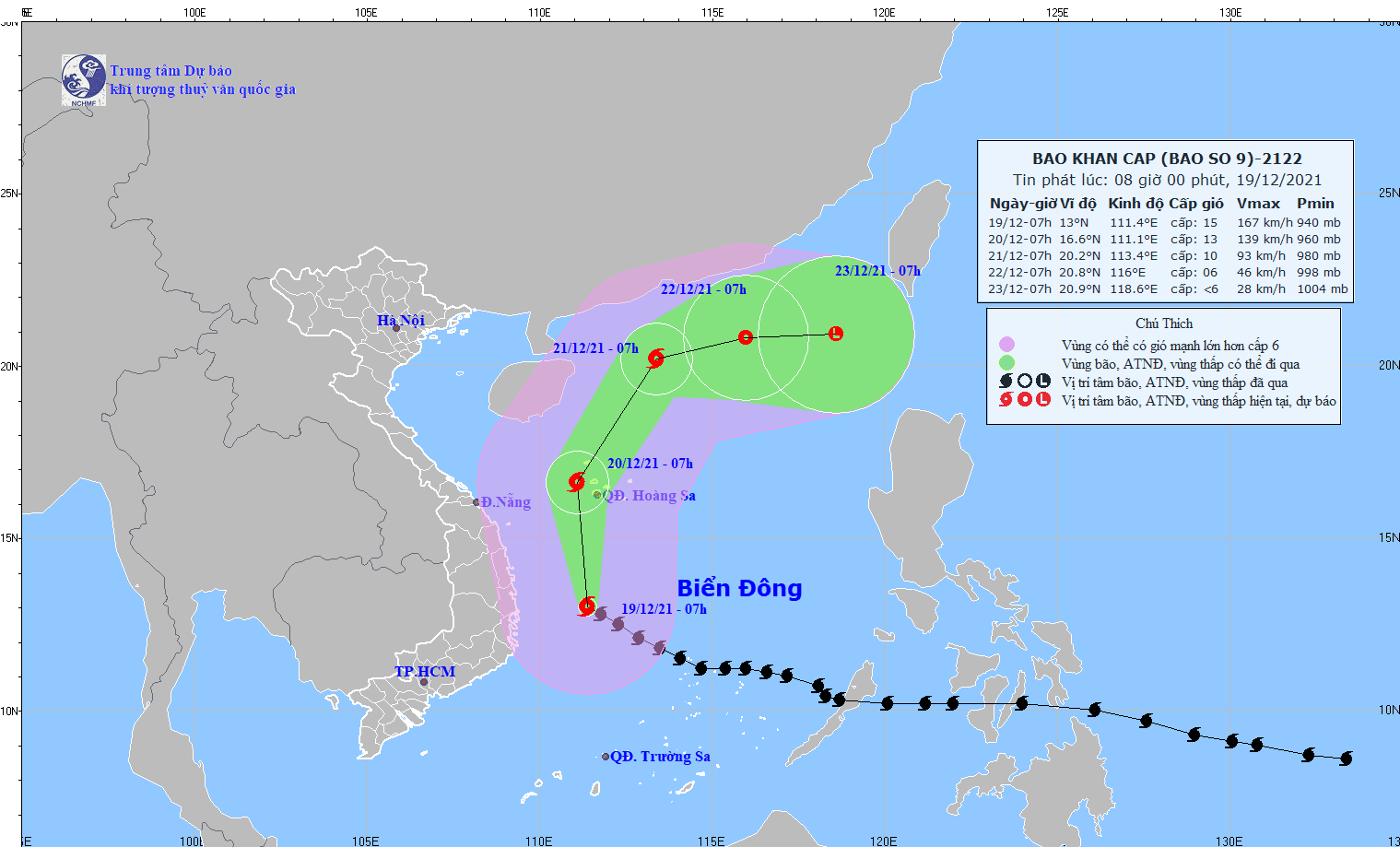
Typhoon Rai, the ninth storm to hit Vietnam this year, was located 230 kilometers east of the country’s south-central region as of 7:00 am on Sunday, according to the National Center for Hydro-meteorological Forecasting.
Wind speed was measured at 150-185km per hour, with gusts reaching up to 220km an hour.
The typhoon will travel northward in the next 24 hours, before switching to the northeast direction in the following 24 to 48 hours.
By 7:00 am on Tuesday, it will have been 260 kilometers southwest of Hong Kong, with wind speed dropping to 75-100km per hour.
The storm is expected to be downgraded to a tropical depression in the next 48 to 72 hours, with winds at 40-50km per hour.
Due to the combine effect of Typhoon Rai and a cold spell, medium to heavy rains are in the forecast from north-central Thua Thien-Hue Province to south-central Phu Yen Province throughout Sunday.
The average rainfall is expected to be around 50 to 100 millimeters, and over 150 millimeters in some areas.
The weather pattern will pose a high risk of flash floods, landslides, and inundation.
Powerful winds and waves will also occur in the northern and central parts of the East Vietnam Sea, as well as along the coast between Thua Thien-Hue and Phu Yen Provinces.
Like us on Facebook or follow us on Twitter to get the latest news about Vietnam!


