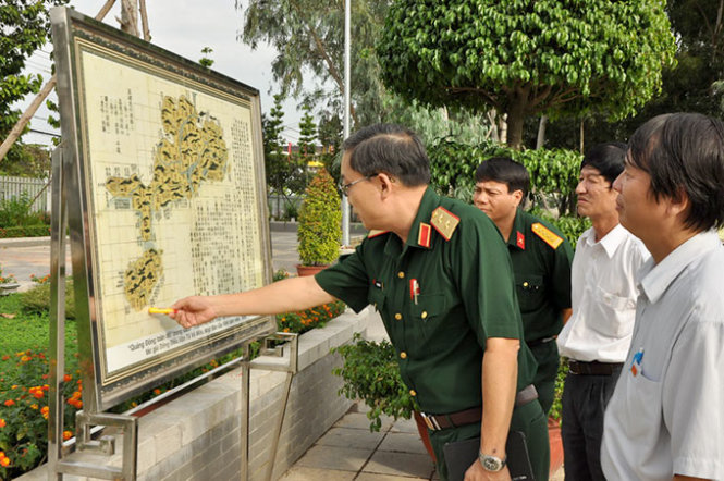
Over 30 ceramic maps accentuating Vietnam’s sovereignty are being displayed at an ongoing exhibit in southern Vietnam’s Dong Nai Province, while another exhibit in Hanoi accentuates the antiques, maps and artworks on the same topic.
The first exhibit, which opened on Wednesday afternoon at the province’s Radio-Television Station in the province’s Bien Hoa City, showcases 31 intricate ceramic maps, which reiterate the country’s sovereignty over its Hoang Sa and Truong Sa archipelagos.
The maps are crafted by Dinh Cong Lai, dean of the pottery faculty of a local college, and his partners, according to Mai Song Be, the station’s director.
It’s the first time such maps are displayed in Bien Hoa City, he added.
In the same vein, another exhibit, themed “Di San Van Hoa, Du Lich Bien Dao Viet Nam” (Vietnam’s Cultural Heritage and Sea and Island Tourism) is running at 2 Hoa Lu, Hanoi until next Monday.
On display are items of Chu Dau pottery dated to the 15th century- one of the country’s hallmark pottery- which were recovered from shipwrecks off Cu Lao Cham Island in the central province of Quang Nam.
Other highlights include collections of fishermen’s tools, artworks themed seas and islands created by artists in Hanoi, as well as hundreds of photos which depict the tourist festivals and life in coastal areas.
The Navy Museum also introduces their 121 archival documents and maps which affirm Vietnam’s sovereignty over Hoang Sa and Truong Sa archipelagos, including 19 UNESCO-recognized historically-significant administrative documents released by kings of the Nguyen dynasty (1802-1945), and 60 century-old maps. Meanwhile, the Museum of Marine Police showcases the photos on China’s illegal deployment of oil rig Haiyang Shiyou 981 in Vietnamese waters in May this year.
The event is part of the “Vietnam’s Seas and Islands Culture and Tourism Week” activities, meant to commemorate the Vietnam Heritage Day on November 23.


