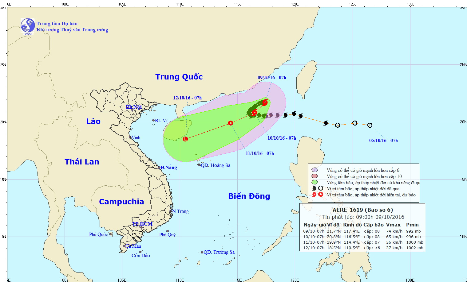
The tropical storm Aere, which formed earlier this week, is expected to change its trajectory while tormenting the East Vietnam Sea, the National Center for Hydro-Meteorological Forecasting (NCHMF) predicted.
Skirting Hong Kong, the storm moved northwards and centered at 21.7 degrees latitude north and 117.4 degrees longitude east at 8:00 am on Sunday, with maximum sustained winds blowing at 60-90 kph.
Over the next 24 hours, Aere is anticipated to head east at 5 kph before changing its path to a west-southwest direction.
It is predicted to be 650 km to the northeast of Vietnam’s Hoang Sa (Paracel) Islands at 7:00 am on Monday, carrying winds registering at eight on the Beaufort scale, ravaging its path with extremely rough seas and strong squalls as high as 11 on the Beaufort scale.
But the storm is likely to downgrade to a tropical depression by Tuesday, about 430 km to the northeast of the Paracels, the NCHMF forecast.
The depression will then accelerate at 10-15 kph, steering itself towards the Chinese island of Hainan before heading further to Vietnam’s central region, according to the weather center.
Under the effect of the southwesterly winds, the southern and central zones of the East Vietnam Sea and the coastal areas from Binh Thuan to Ca Mau Provinces are expected to have rainy squalls and rough seas with 1.5-2.5 meter high waves.
Like us on Facebook or follow us on Twitter to get the latest news about Vietnam!


