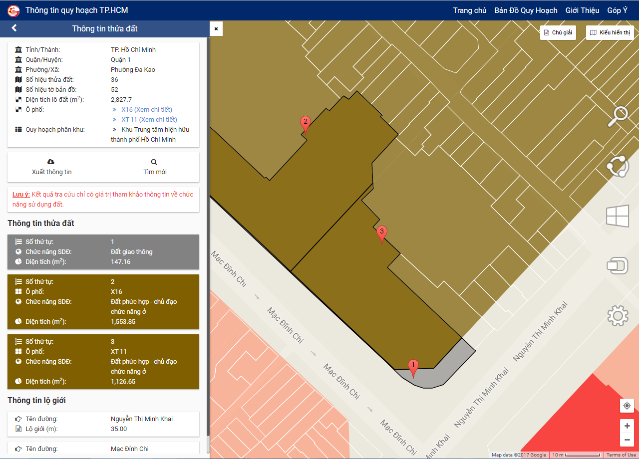
Residents and investors can now view all land-use planning in Ho Chi Minh City in a matter of minutes thanks to a new website and mobile app launched by the municipal Department of Planning and Architecture.
The platforms, launched on Thursday, allow users to view information regarding the state of a piece of land including its area, road width and usage planning at the ease of simple clicks.
Users can either input the coordinates of a piece of land or search for their desired location manually on the database, which is presented in a style similar to web mapping services like Google Maps.
An integrated GPS capability allows users to instantly navigate to their current location on the map.
Each piece of land is color-coded according to their planning state, which can be exported as a PDF file for convenience of download and printing.
Users can also toggle between the digital and paper versions of the planning map.
 |
| The web version interface of the database on land use planning in Ho Chi Minh City. |
The website is accessible at http://thongtinquyhoach.hochiminhcity.gov.vn/, while the mobile app is available for Android and iOS devices under the name of ‘Thong tin quy hoach TP.HCM’.
Speaking at the launch of the database on Thursday, Ho Chi Minh City’s deputy chairman Tran Vinh Tuyen said the new website and app would not only help improve land governance but also make it more convenient for residents and investors to inspect the state of any given piece of land.
Such transparency is expected to help curb corruption and bureaucracy from the part of authorities when handling land issues, Tuyen said.
“These platforms lay the groundwork for the city to develop other applications to manage construction, underground space and buildings on the surface,” Tuyen stressed.
Like us on Facebook or follow us on Twitter to get the latest news about Vietnam!


