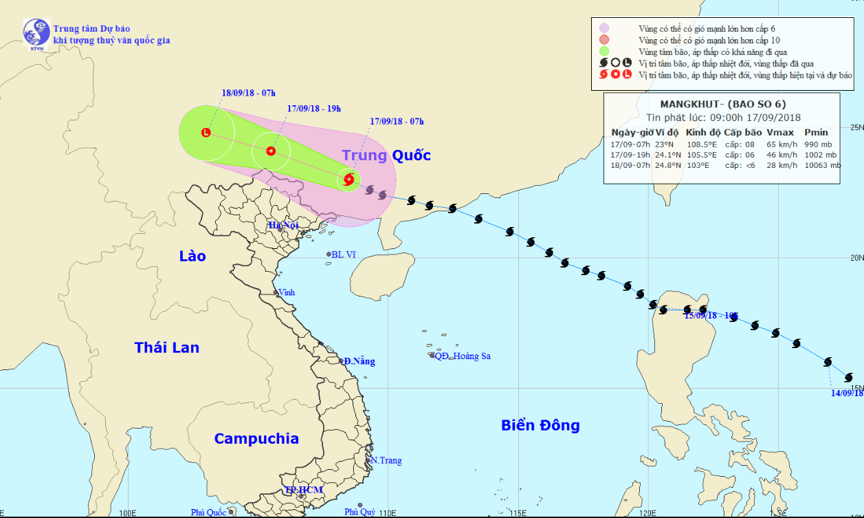
Although super typhoon Mangkhut has been forecast to weaken as it sweeps through mainland China on Monday, its circulation will still bring heavy downpours to northern Vietnam.
The typhoon was located in the southern part of China’s Guangxi Province as of 7:00 am on Monday, with average wind speed recorded at 60 to 75km per hour, according to the National Center for Hydro-meteorological Forecasting.
Mangkhut, which is considered this year’s most powerful storm in the Pacific Ocean, killed at least 64 people in the Philippines after making landfall in the country on Friday last week.
It entered the East Vietnam Sea on Saturday night and became Vietnam’s sixth storm in 2018, before making the second landfall in southern China's Guangdong Province on Sunday.
 |
| A map detailing the route of Typhoon Mangkhut on September 17 and 18, 2018. Photo: National Center for Hydro-meteorological Forecasting |
In the next 12 hours, Mangkhut is expected to travel northwestward at 25 to 30km an hour before weakening into a tropical depression.
The tropical depression will be in China’s Yunnan Province by 7:00 pm on Monday, releasing winds at 40 to 50km per hour.
The low-pressure system will continue diminishing in the next 12 to 24 hours.
Under the influence of the storm’s circulation, downpours are forecast to dampen northern Vietnam from September 17 to 19.
Floods may also occur in the region as water levels in the Red River and Thai Binh River are expected to rise.
Flashfloods and landslides are also likely to happen in mountainous provinces.
Like us on Facebook or follow us on Twitter to get the latest news about Vietnam!


