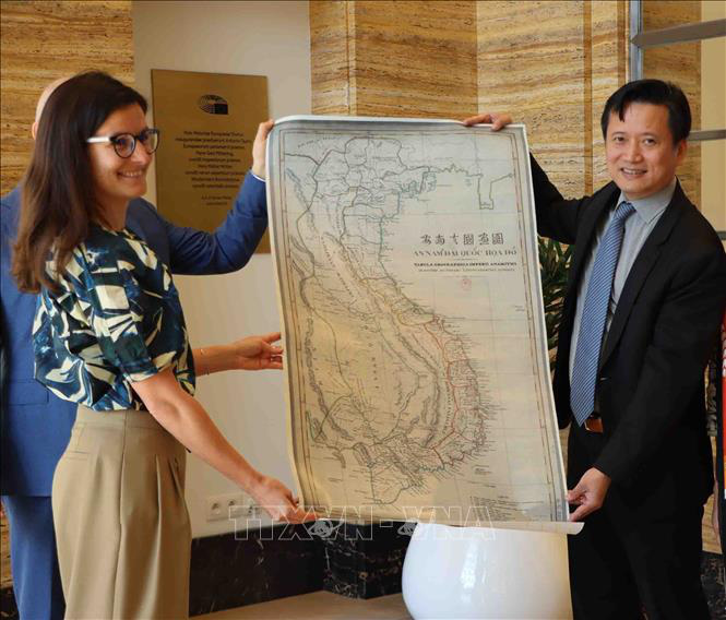
Vice-President of the Diplomatic Academy of Vietnam Nguyen Hung Son presented the ‘An Nam Dai Quoc Hoa Do’ (Map of the Great Country of An Nam) to the House of European History in Brussels, Belgium on Thursday (local time), the Vietnam News Agency reported.
The map, measuring 84 centimeters long and 45 centimeters wide, was drawn by Jean Louis Taberd, a Frenchman, and published in Serampore, India in 1838.
It was the largest and most detailed map of Vietnam at the time.
Its name is written in three languages, namely Chinese characters, Vietnamese national scripts, and Latin scripts.
All landmarks on the map, including those in China, Laos, and Cambodia, are written in Vietnamese scripts, while the footnotes are presented with Vietnamese, Latin, and French characters.
Giving the ‘An Nam Dai Quoc Hoa Do’ to the House of European History is an idea of the Vietnamese Embassy in Brussels, which shows the close relations between Vietnam and Belgium in politics, culture, and history.
It also reflects Vietnam’s wish to help European friends better understand the Vietnamese history and give them a deeper insight into the history of the East Vietnam Sea.
Simina Badica, a curator at the House of European History, said that the museum is keeping and exhibiting items from more than 200 countries.
Badica expressed her delight to receive the map from Vietnam, which will help researchers and visitors have a proper understanding of the geographical history of the Southeast Asian country.
This is the first time that the venue has received an item from Vietnam, she noted, hoping that cooperation and exchange between the two sides in history and culture will continue to expand.
Like us on Facebook or follow us on Twitter to get the latest news about Vietnam!


