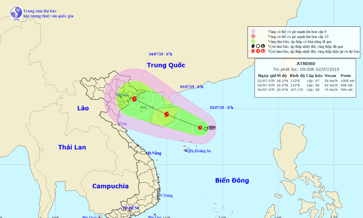
A tropical depression in the East Vietnam Sea is forecast to strengthen into a storm, bringing massive rainfall to northern and north-central provinces, according to the National Center for Hydro-meteorological Forecasting.
The low-pressure system was located about 190 kilometers northeast of Vietnam’s Hoang Sa (Paracel) archipelago as of 7:00 am on Tuesday, packing winds at 40 to 60km per hour and gusts at up to 80km an hour.
It is expected to travel northwest in the next 24 hours and gather enough strengths to become a storm.
The storm will be located on China’s Hainan Island as of 7:00 am on Wednesday, with average wind speed increasing to between 60 and 75km per hour and gusts reaching 115km an hour.
It is expected to hit the Vietnamese coast from northern Quang Ninh to Nam Dinh Provinces on Thursday morning.
Under the influence of the weather phenomenon, heavy downpours are forecast to dampen northern and north-central Vietnam on Wednesday and Thursday, posing high risks of flashfloods and landslides in mountainous areas.
According to Hoang Phuc Lam, deputy director of the National Center for Hydro-meteorological Forecasting, torrential rain will help prevent wildfires in north-central provinces.
However, downpours that follow forest fires and a long period of hot and dry weather can be highly dangerous as they can cause mudslides in certain areas, Lam elaborated.
Raging blazes engulfed large sections of forests in Ha Tinh, Nghe An, Quang Binh, and Thua Thien-Hue Provinces in the north-central region over the weekend.
Ha Tinh suffered the most serious damage, as wildfires broke out in seven districts between Friday and Sunday, destroying hundreds of hectares of forest.
All of the fires were put under control as of Monday, but local authorities were worried that they could flare up again due to high temperatures.
Like us on Facebook or follow us on Twitter to get the latest news about Vietnam!


