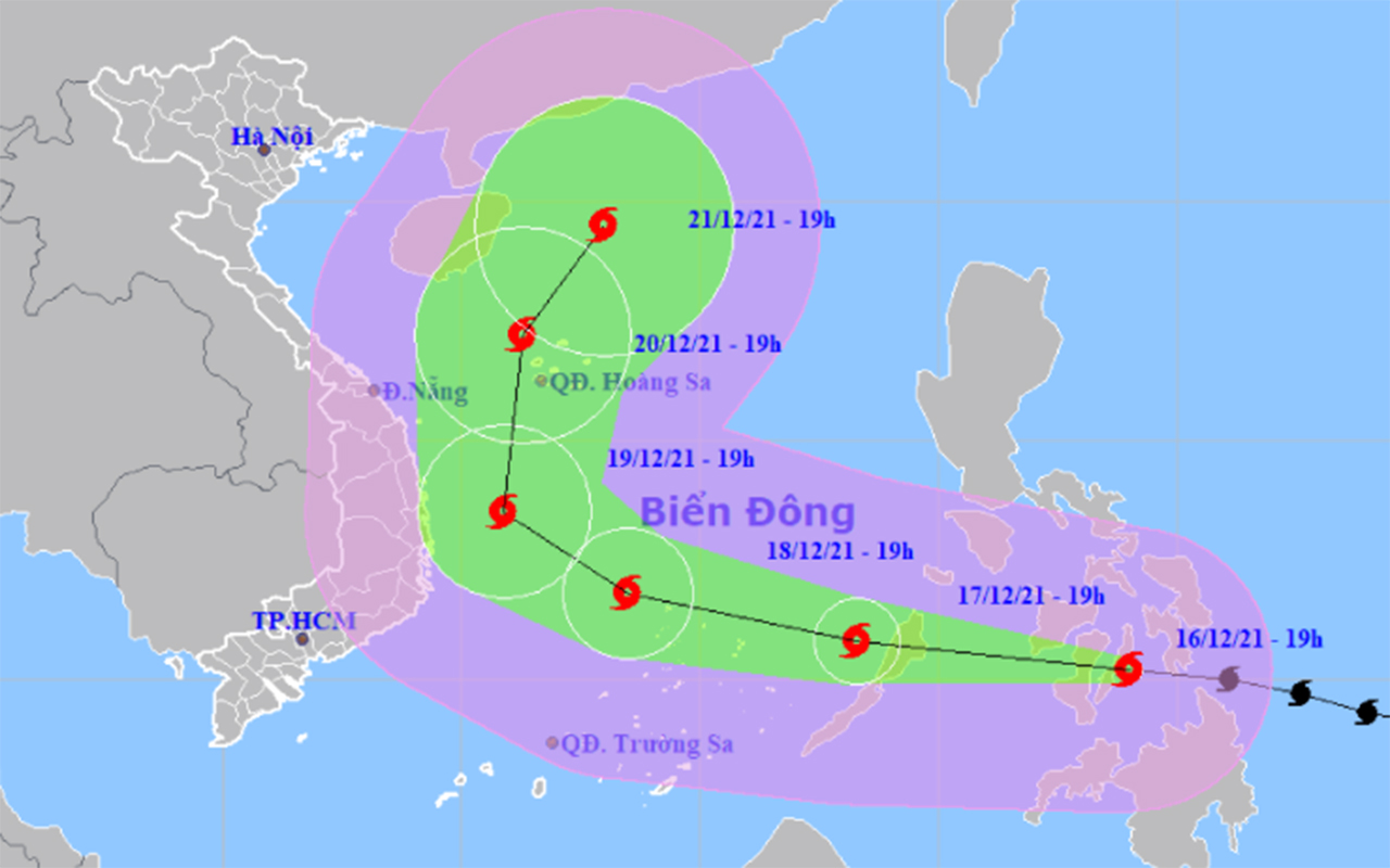
Typhoon Rai is showing unusual development signs as it is forecast to head toward northern Vietnam instead of the southern region.
Tropical storms that form in December often enter the southern part of the East Vietnam Sea and affect the weather conditions in southern Vietnamese provinces, according to Tran Quang Nang, an official from the National Center for Hydro-meteorological Forecasting.
However, Typhoon Rai may head north after entering the East Vietnam Sea, Nang continued.
As of 7:00 am on Friday, Rai was located in the maritime area off the central Philippines, packing winds of 150-185km per hour and gusts of up to 220km an hour.
The typhoon will travel northwest over the next 24 hours and arrive in the East Vietnam Sea around Friday evening.
By 7:00 am on Saturday, it will have been 200 kilometers east of Song Tu Tay Island in Vietnam's Truong Sa (Spratly) archipelago, with wind speed reducing to 135-165km per hour and gusts of up to 220km an hour.
The typhoon will then travel toward northern Vietnam and gradually weaken along the way.
“We have counted all possibilities, figuring out a 80 percent chance that the typhoon will travel northward,” Nang elaborated.
It is possible that Rai will head toward central or southern Vietnam, but chances are quite low, he continued.
Nang stressed that after entering the East Vietnam Sea, Rai will still be a very powerful storm compared to others in recent years.
Along with an enhanced cold front, the typhoon will result in very strong winds and waves as high as 10 meters in the central part of the East Vietnam Sea.
All ships must avoid entering the affected area in the coming days, the official said.
Like us on Facebook or follow us on Twitter to get the latest news about Vietnam!


