The Lam Dong People’s Committee has announced its plan to develop a comprehensive landslide risk map for the entire Central Highlands province of Vietnam, starting with the capital city of Da Lat, in response to the recent landslides in the area.
Nguyen Ngoc Phuc, deputy chairman of Lam Dong Province, unveiled the plan after the provincial administration invited a team of three geologists from Kawasaki Geological Engineering Co. Ltd., a Japan-based geological survey company, to Da Lat to conduct surveys in certain areas susceptible to landslides on Tuesday.
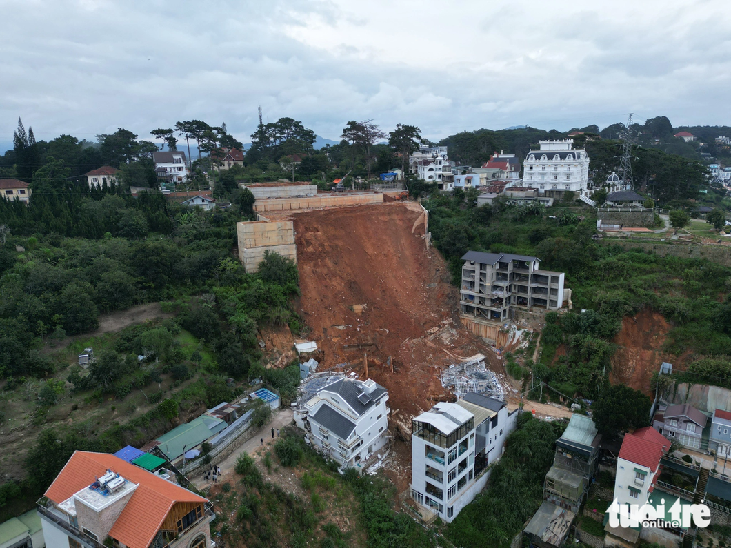
The surveyed areas included Alley 36 down Hoang Hoa Tham Street in Ward 10, where a landslide, triggered by torrential rain, claimed the lives of two construction workers and destroyed several houses in late June.
The geologists also identified Khe Sanh and Dang Thai Than Streets as locations prone to landslides.
Previously, Da Lat witnessed two serious landslides, with one on Khe Sanh Street in 2021 and the other in the Hoa Binh area in 2017.
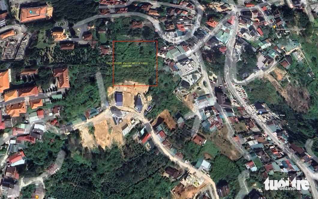
Takami Kanno, head of Kawasaki Company’s representative office in Hanoi, pointed out that satellite images revealed partially erosive spots on Hoang Hoa Tham Street in both 2010 and 2015.
The area affected by landslides and fractures was then entirely refilled with soil in 2017-20, resulting in a loose structure.
During the evaluation, the experts also noted that the construction materials used for the railings failed to meet the required standards, leaving them vulnerable to the pressure exerted by approximately 20,000 cubic meters of additional soil, rocks, and accumulated rainwater.
|
|
| The scene of a fatal landslide in late June 2023 in Da Lat City, Lam Dong Province, Vietnam. Photo: M.V. / Tuoi Tre |
Drawing from Japan’s expertise in handling and preventing landslides, the experts made several recommendations regarding local management, licensing, and supervision of embankment projects; establishment of safety standards for landslide prevention; and deployment of advanced equipment, drainage systems, and backfilling techniques.
Apart from amending construction regulations, the Japanese experts emphasized the importance of issuing a warning map for landslide-prone regions and utilizing data from satellite images.
Authorities are advised to visit these locations to confirm their risk levels, and if deemed necessary, conduct geological drilling for exploration.
Should an area be identified as being at risk of landslides, appropriate construction management regulations should be implemented accordingly.
In response, deputy chairman Phuc stated that the province took into account the recommendations of experts to make decisions on upcoming measures.
These include the development of an erosion risk map and the installation of landslide warning devices in specific residential areas, thus perfecting regulations concerning building permits in regions susceptible to landslides.
Like us on Facebook or follow us on Twitter to get the latest news about Vietnam!


