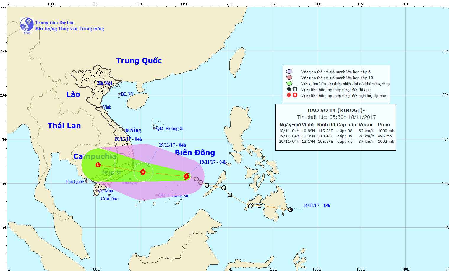
A tropical depression that formed near the Philippines’s Palawan Island on Thursday night has developed into a storm early on Saturday and is heading toward Vietnam’s south-central coast.
As of 5:00 am on Saturday, the storm’s eye was recorded on the east side of Vietnam’s Truong Sa (Spratly) archipelago in the East Vietnam Sea, packing winds of 60-75 kilometers per hour, according to the National Center for Hydro-meteorological Forecasting.
This is the 14th storm to hit Vietnam this year, following the devastating typhoon Damrey, the deadliest so far in 2017, earlier this month and the lesser intense storm Haikui last weekend.
Within the next 24 hours, the storm will travel west and/or northwest at an anticipated speed of 25kph, gathering strength along its way.
By 4:00 am on Sunday, the storm is expected to reach an area some 150km east of the coast of south-central Khanh Hoa and Binh Thuan Provinces, packing winds as strong as 60-90ph.
During the next 24 to 48 hours from that point, the storm will continue to travel west and/or northwest at an average speed of 20 to 25kph.
It is forecast that the storm will gradually weaken into a tropical depression, and later a low-pressure zone, upon reaching the mainland in south-central Vietnam.
By 4:00 am on Monday, the center of the low-pressure zone is predicted to be located in southern Cambodia.
Rains and thunderstorms are forecast for the central and southern areas of the East Vietnam Sea, whereas waters off the coast from Binh Dinh to Ba Ria – Vung Tau Provinces will experience rough seas from Sunday morning.
Typhoon Damrey, the 12th storm to hit Vietnam this year, killed at least 106 people while leaving 25 missing and 197 injured.
Like us on Facebook or follow us on Twitter to get the latest news about Vietnam!


