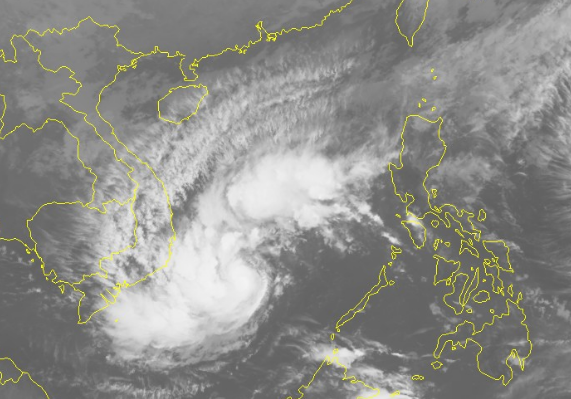
A tropical depression developed into a storm on Thursday afternoon and is now heading towards south-central and southern Vietnam carrying heavy rains into the regions over the next few days.
Typhoon Usagi is the ninth storm to Vietnam this year, according to the National Center for Hydro-meteorological Forecasting.
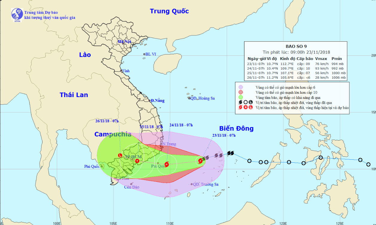
As of 7:00 am on Friday, it was located at about 410 kilometers off the coast of the south-central province of Ninh Thuan, packing winds at 75 to 90km per hour and gusts at 115km an hour.
The storm will travel southwest at about 10 to 15km per hour over the next 24 hours, picking up strength along the way.
Usagi is expected to reach within 150 kilometers of Ninh Thuan Province by 7:00 am on Saturday.
Wind speeds are forecast to increase to 75 to 100km per hour, with gusts expected at 130km an hour.
 |
| A map detailing the route of the storm from November 23 to 26, 2018. Photo: National Center for Hydro-meteorological Forecasting |
Over the next 24 to 48 hours, the storm will travel westward and make landfall in south-central and southern Vietnam, battering the region with 75kph winds before downgrading to a tropical depression.
Due to the combined effects of the storm circulation and an existing cold spell, a massive rainfall of between 300 and 500 millimeters will dampen localities from north-central Thua Thien- Hue Province to south-central Binh Thuan Province, as well as several areas in the Central Highlands from November 23 to 26.
Southern Vietnam, including Ho Chi Minh City, will also be hit with downpours of 100 to 200 millimeters during the same period.
Floods may also occur along rivers in the central region and Central Highlands.
Torrential rains will also raise the risks of landslides, flashfloods, and inundation.
Authorities in affected provinces have applied certain measures to brace for the storm and minimize its consequences.
Like us on Facebook or follow us on Twitter to get the latest news about Vietnam!


