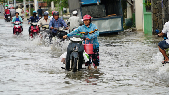
Tide levels in Ho Chi Minh City are on the rise and are projected to soar over 1.7 meters, which threatens flooding in low-lying and riverfront areas.
As recorded at Phu An Station near the Saigon River and Nha Be Station near the Dong Dien River, tide levels have risen to 1.67 – 1.72 meters, exceeding the 1.5-meter floor of alarm level 3.
High tides are seen to peak between 4:00 – 6:00 am and 5:00 – 7:00 pm.
On top of that, satellite images and weather radar results indicate the robust development of cumulus clouds to the north, east, and central regions of Ho Chi Minh City, the Southern Hydro-meteorological Center reported.
Existing rain-inducing clouds in Long An and Tien Giang Provinces are also heading northeast toward Ho Chi Minh City.
At midday and in the afternoon, these clouds will enkindle heavy rain and thunderstorms in the city. Strong wind gusts, whirlwinds, and lightning strikes are expected.
The combination of high tides and torrential rain will give rise to heavy inundation in low-lying areas and riverfront locales in Ho Chi Minh City.
Hence, preemptive measures to consolidate key river embankments are recommended to prevent breakage.
Like us on Facebook or follow us on Twitter to get the latest news about Vietnam!


