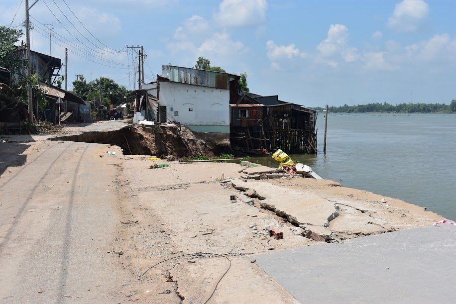
Following a recent riverbank collapse in the southern Vietnamese province of An Giang that sank 14 houses, several other residences in the locality are facing a similar threat, with authorities identifying at least 51 at-risk locations.
Vu Hung Dung, deputy director of the provincial Department of Natural Resources and Environment, on Wednesday morning led a working delegation to Kien Thanh Commune, Cho Moi District, where a crack was discovered on a street running along a local canal two days ago.
The situation was reported to local authorities who then fenced off the area for safety.
“The crack is two to four centimeters wide and spans 30 meters, creating an extremely high risk of collapse if the road continues to bear a large amount of traffic,” Dung elaborated.
According to the An Giang Department of Transport, several other streets along local rivers and canals also face the potential risk of collapse.
Several sections of provincial road 946, also in Cho Moi District, are considered at risk, leading to local authorities banning heavy trucks from traveling the route.
Meanwhile, in An Phu District, subsidence has caused damage to a street adjacent to the Binh Di River.
Competent agencies in An Giang have warned that at least 51 additional locations across Cho Moi, Chau Phu, and An Phu Districts, as well as Long Xuyen City could potentially be impacted by the phenomenon.
During a meeting with the Ministry of Natural Resources and Environment on Tuesday, An Giang authorities requested the relocation of 20,000 households due to the increasing threat of serious subsidence along local rivers.
The proposal came after a severe bank collapse along the Vam Nao River last weekend in which some 14 houses in My Hoi Dong Commune, Cho Moi District, completely sank.
As the neighborhood is still under the effect of the situation, about 108 households have been evacuated and are sheltering at the homes of other residents.
Like us on Facebook or follow us on Twitter to get the latest news about Vietnam!


