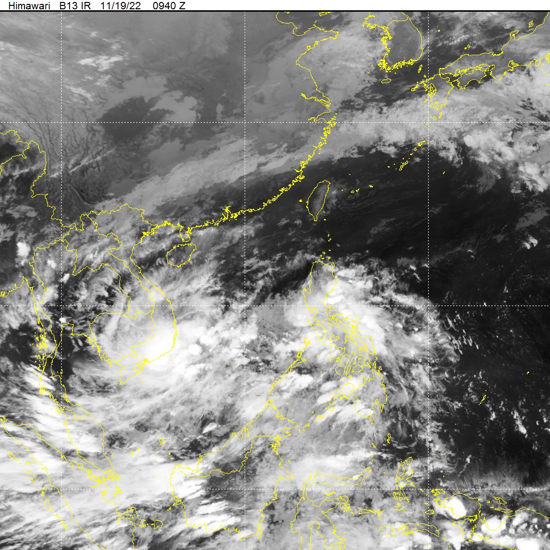
A low-pressure area appeared in the East Vietnam Sea on Saturday and is forecast to pick up strength and bring rains to central and southern provinces over the next few days.
The low-pressure area was located in the southern part of the East Vietnam Sea as of Saturday afternoon, the National Center for Hydro-meteorological Forecasting reported.
It was forecast to move westward in the next 24 hours and pick up strength.
Due to the combined effect of the low-pressure area and a trough, showers and strong thunderstorms were recorded in the central and southern parts of the East Vietnam Sea, as well as the maritime area from north-central Quang Tri Province to southern Ca Mau Province, on Saturday night and Sunday morning.
Rains also dampened many provinces in the central, south-central, southern, and Central Highlands regions on Saturday.
Medium to heavy downpours are expected to continue lashing these regions until the end of Tuesday.
The average rainfall will be 100-200 millimeters between north-central Quang Tri Province and south-central Binh Thuan Province, and 70-150 millimeters in the Central Highlands.
In southern localities, the rain volume will be about 50-100 millimeters.
Rains are expected to decrease in intensity starting Wednesday.
The weather pattern will pose a high risk of flooding along rivers in the localities from Quang Tri to Binh Thuan, as well as flash floods and landslides in mountainous areas.
Like us on Facebook or follow us on Twitter to get the latest news about Vietnam!


