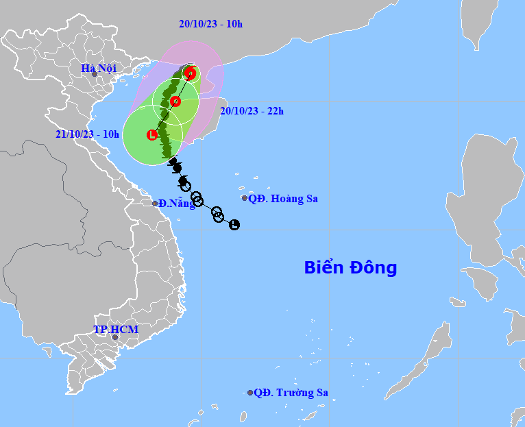
Storm No. 5, the fifth to hit Vietnam this year, strengthened further as it moved into the northern waters of the Gulf of Tonkin on Thursday evening, packing winds of 88 kilometers per hour, according to the national weather center.
However, the storm is unlikely to continue accelerating due to a cold air mass in the north which has moved downward, the National Center for Hydro-Meteorological Forecasting predicted.
At 10:00 am on Friday, the storm was traveling south-southwest at some 10 kilometers per hour and remained in the northern waters of the Gulf of Tonkin, packing winds of 74 kilometers per hour.
It is expected to continue its south-southwest track and gradually downgrade to a tropical depression by 10:00 pm on Friday.
The system will likely move southwest at around 15 kilometers per hour and weaken to a low pressure area by 10:00 am on Saturday.
Due to the impact of the storm plus the intensive cold air mass, the Gulf of Tonkin area, including Co To Island off Quang Ninh Province and Bach Long Vi Island off Hai Phong City, both in northern Vietnam, could experience strong winds and rough seas.
All fishing vessels, wharfs, aquaculture farming areas, and dykes in these areas could be impacted by strong winds and high waves.
Like us on Facebook or follow us on Twitter to get the latest news about Vietnam!


