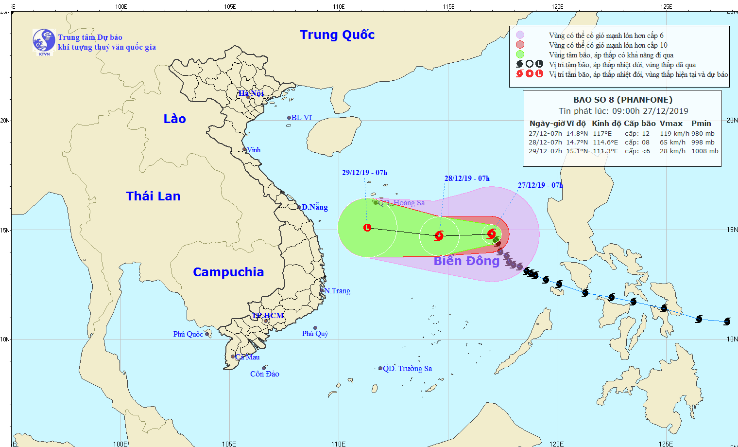
Tropical storm Phanfone has been unleashing strong winds in the East Vietnam Sea, but it is expected to weaken before making landfall.
Phanfone, the eighth storm to hit the Southeast Asian country this year – and predicted to be the last – was located at about 550 kilometers southeast of Vietnam's Hoang Sa (Paracel) archipelago as of 7:00 am on Friday, carrying with it winds of 100-135km per hour and gusts of 165km an hour.
According to the National Center for Hydro-meteorological Forecasting, the storm is forecast to travel westward over the next 24 hours and will be situated just 350 kilometers southeast of Hoang Sa by Saturday morning where its average wind speed will decrease to between 60 and 75km per hour.
The following 24 to 48 hours will see the storm continue heading west as it weakens into a tropical depression.
By Sunday morning, the low-pressure system will have been located at 210 kilometers southwest of Hoang Sa with wind speed at under 40km per hour.
Phanfone has brought high waves and strong gusts to the northern part of the East Vietnam Sea.
As of Friday morning, a cold front swept into localities throughout northern Vietnam and some parts of the north-central region, while causing strong winds near the Gulf of Tonkin.
The cold snap is forecast to bring showers and low temperatures to Vietnam on Friday.
Lows in Hanoi and other provinces in the Red River Delta will hit 13-16 degrees Celsius while that number could drop to below ten degrees Celsius in mountainous areas.
Average lows in southern Vietnam will be at between 21 and 24 degrees Celsius on Friday.
Like us on Facebook or follow us on Twitter to get the latest news about Vietnam!


