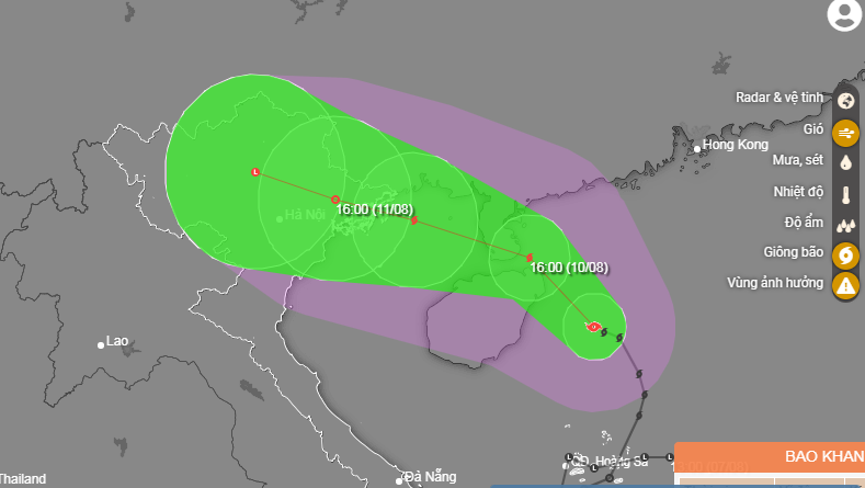
A tropical depression in the East Vietnam Sea strengthened into a storm on Tuesday and is expected to bring heavy downpours to northern and north-central provinces over the next few days.
Storm Mulan, the second to hit Vietnam this year, was located 480 kilometers southeast of northern Quang Ninh Province at 7:00 am on Wednesday, according to the National Center for Hydro-meteorological Forecasting.
The highest wind speed was recorded at 62-88km per hour with gusts up to 117km an hour.
The storm is forecast to travel northwest in the next 24 hours and is expected to be 70 kilometers south of Quang Ninh, packing winds of 62-74km per hour.
It will continue heading northwest in the next 24-48 hours and weaken into a tropical depression above northern Vietnam.
Due to the influence of Storm Mulan, torrential rains of 100-200 millimeters will lash northern localities as well as north-central Thanh Hoa and Nghe An Provinces from Wednesday evening to Friday.
Powerful winds are also expected along the coast between Quang Ninh and Ninh Binh Provinces in northern Vietnam.
Rough seas will occur in the northern part of the East Vietnam Sea and the area around the Gulf of Tonkin.
Meanwhile, a strong southwest monsoon is forecast to cause rough seas and high waves in the central and southern sections of the East Vietnam Sea.
Like us on Facebook or follow us on Twitter to get the latest news about Vietnam!


