Is climate change lighting a fuse under Iceland's volcanoes?
Sunday, October 27, 2024, 10:19 GMT+7

Scientists are racing to find out whether the rapid retreat of glaciers could drive a surge in eruptions as magma builds under the island nation — and if so, whether the same might occur at ice-covered volcanoes around the world, putting many lives at risk.
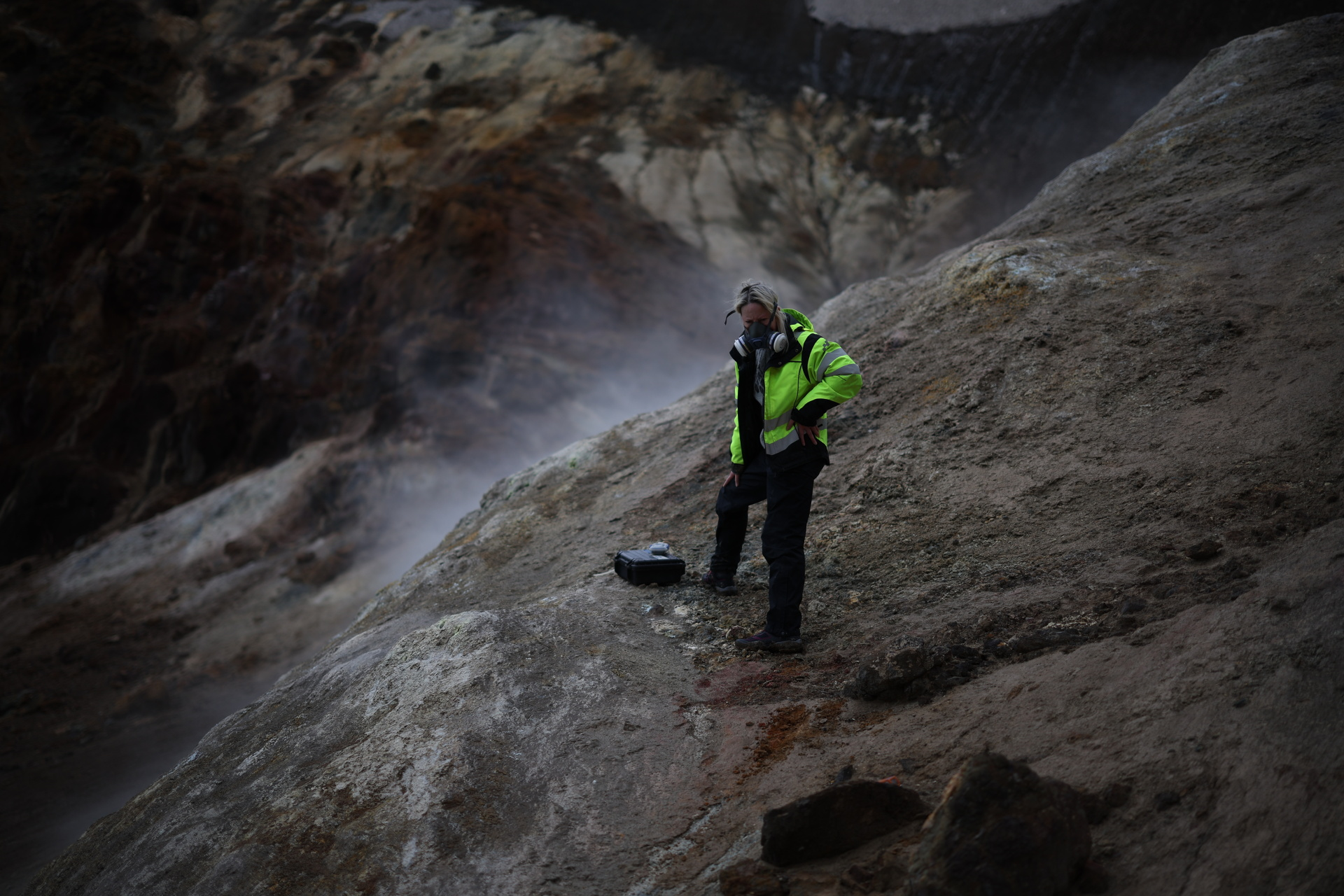
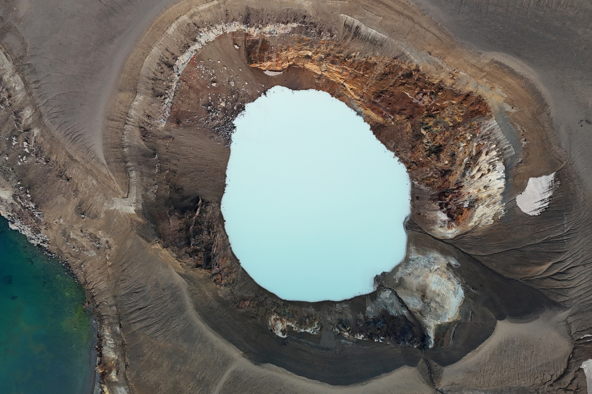
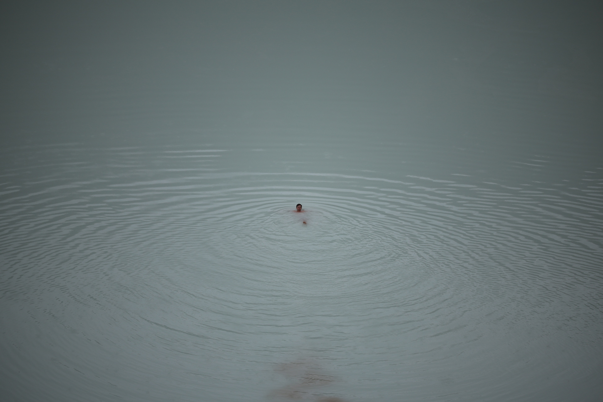
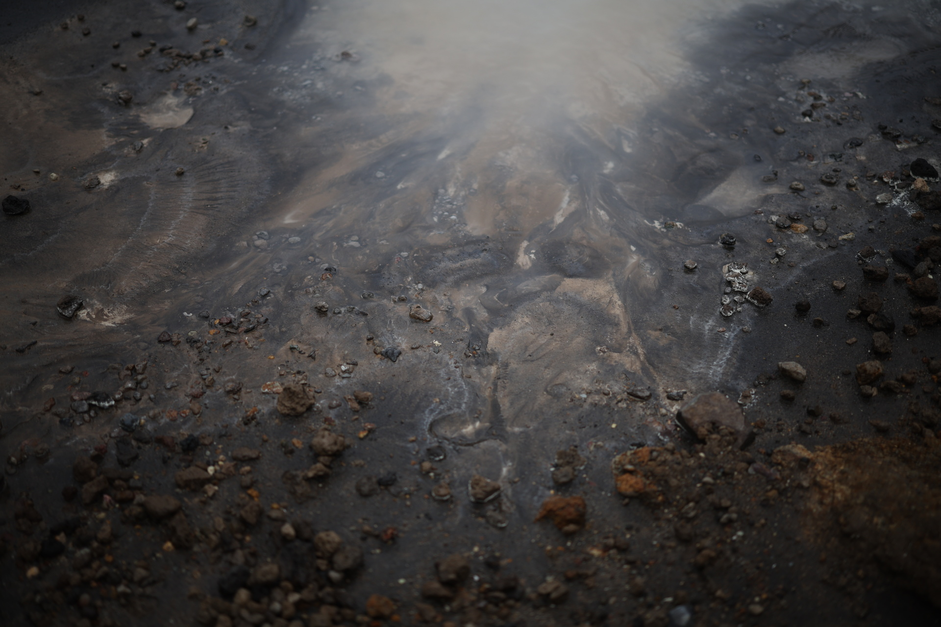
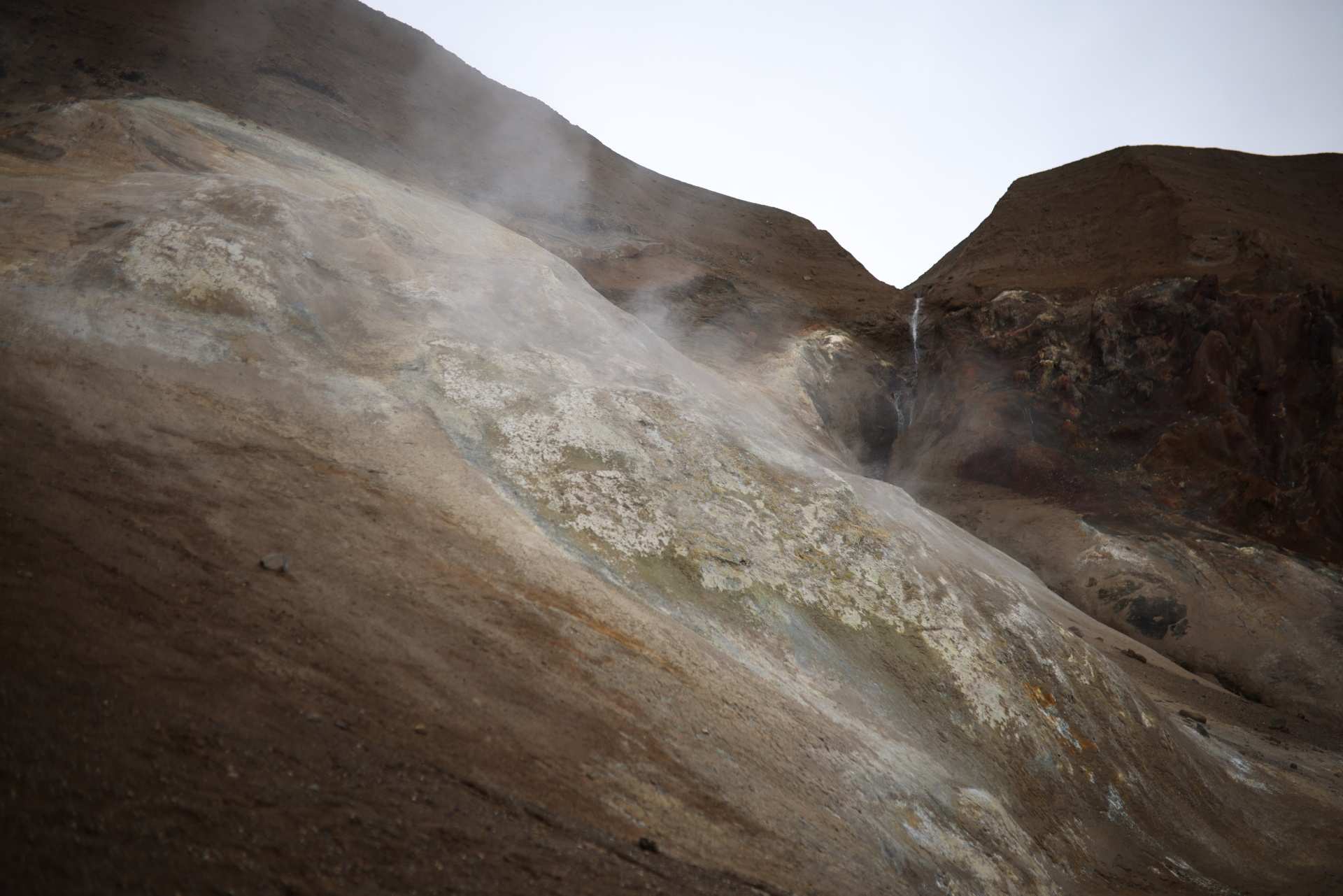
Toxic sulphurous gas, carrying the telltale reek of rotten eggs, wafted through vents in the steep walls of Iceland’s Viti crater, while carbon dioxide bubbled to the surface of the milky blue crater lake. Veils of steam wreathed the landscape of loose rock in eerie half-light.
hrough this forbidding terrain – “Viti” is derived from the Icelandic for “hell” – Michelle Parks, a volcanologist with the Icelandic Meteorological Office, picked her way toward the water’s edge one day last August. With a monitor strapped to her hip to warn her if the gases reached dangerous levels, she stooped to submerge a temperature probe in the lake – 26.4 degrees Celsius (79.5 degrees Fahrenheit), consistent with recent readings.
|
|
| Volcanologist Michelle Parks takes readings of the gases seeping out of vents in Viti crater. Photo: Reuters |
That was reassuring, at least for the time being. The crater was formed when Askja, a volcano in Vatnajokull National Park in Iceland’s central highlands, uncorked in an explosive eruption in 1875. Askja’s last eruption, in 1961, was milder, and for decades after, the volcano was quiet. But in 2021, Parks and other scientists keeping tabs on it were shocked to find that in just a few months, the volcano had rapidly expanded, uplifting by 11 centimetres (4.3 inches). This phenomenon, called inflation, occurs when magma or pressurised gases accumulate under a volcano, pushing the ground upwards and outwards.
In the three years since, Askja’s bloat has reached about 80 cm (32 inches). That uplift, scientists estimate, is the result of 44 million cubic metres (1.6 billion cubic feet) of magma flowing into the existing reservoir around three km (two miles) beneath the surface.
|
|
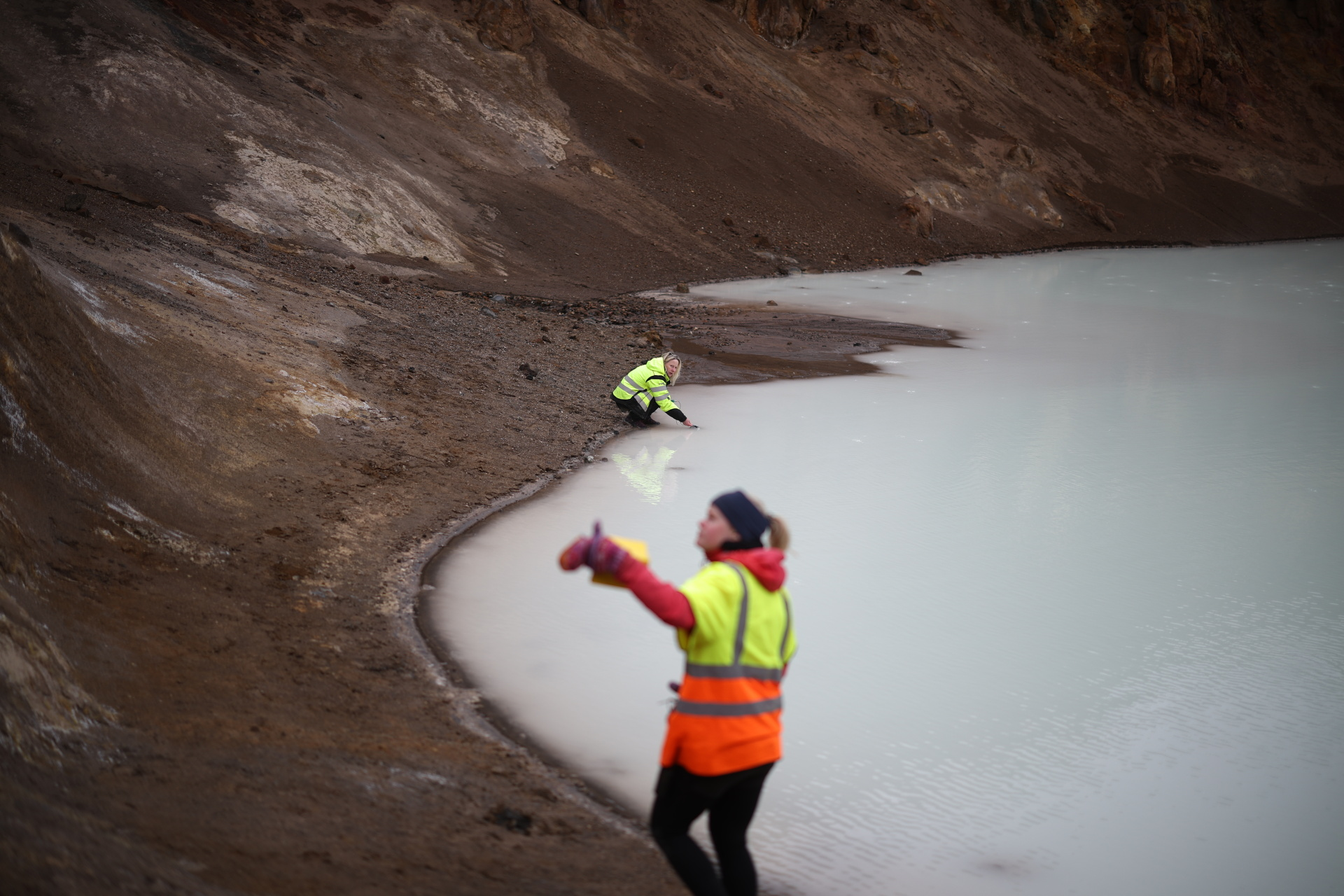
| Parks and Icelandic Meteorological Office geophysicist Asta Rut Hjartardоttir monitor the temperature and acidity of the Viti crater lake for signs of increased volcanic activity underground. Photo: Reuters |
Volcanologists have established a correlation between magma buildup under a volcano and subsequent eruption. But they don’t know exactly how much magma is needed to help trip an eruption. That is why Parks and her colleagues are closely monitoring the temperature and acidity of Viti’s crater lake. A jump in either, indicating that more gases are pushing in from below, would suggest the volcano is moving closer to an eruption. So far, those metrics have remained stable, but the scientists watching Askja don’t take that for granted.
“There’s so much uncertainty on when this will erupt — if it will erupt,” Parks said. It could be years, or decades, she said, or “it could be sooner.”
An eruption could be catastrophic, though smaller ones are much more likely. On the scale volcanologists use to measure the size of explosive eruptions, Askja is capable of one equivalent to that of Mount St. Helens in the U.S. state of Washington in 1980, although its eruptive style would differ. That eruption, which sparked the Australia-born Parks’ lifelong passion for volcanoes, unleashed a force equivalent to 25,000 Hiroshima-type atomic bombs.
|
|
| Viti crater and its milky blue lake are a big tourist draw. Photo: Reuters |
The aim of the volcano observatory at the Icelandic Meteorological Office is to monitor the country’s volcanoes for changes in activity, like those now observed at Askja, helping to protect the nation’s nearly 400,000 citizens and the hordes of foreign tourists who visit every year to enjoy Iceland’s world-renowned geothermal attractions.
However, the team’s work has taken on broader significance. Last year, Parks and colleagues with the University of Iceland received government funding for a pioneering research project across 12 institutions to test a theory that could have dire implications not just for Iceland, but for every person on the planet: Whether the rapid retreat of glaciers as a result of human-caused climate change will trigger increased volcanic activity.
The basic process underpinning the idea is simple. The tremendous weight of glaciers and ice sheets can tamp down volcanoes. When the ice retreats, the downward pressure on the planet’s thin outer crust and much thicker underlying mantle eases, allowing the ground to rebound. This change in pressure spurs dynamic forces beneath volcanoes to produce more magma and alter its movement, influencing eruptions.
|
|
| Viti crater was formed in the 1875 eruption of the volcano Askja, now part of Vatnajokull National Park. Photo: Reuters |
“Iceland is essentially one of the best places in the world to study this … because we have both volcanism and glaciers,” Parks said. “At the end of the day, what we’re aiming for with this project is a much bigger picture. It’s the future of volcanic eruptions. How large can they be? … And what’s in store for us in the future, not only in Iceland but for the rest of Europe and potentially farther afield.”
Uncorking cataclysm
What scientists already know of Iceland’s eruptive history supports the theory.
When the thick glaciers and ice caps that had covered the North Atlantic island during the last major Ice Age receded between about 15,000 and 10,000 years ago, underlying volcanoes responded with fury. In 2002, scientists calculated changes in Iceland’s volcanic activity over time by analysing the chemical composition of lava rock samples. They found that eruption rates surged an estimated 30 to 50 times during and shortly after the ice loss compared to the preceding Ice Age and recent times.
|
|
| The town of Vik would be at risk of annihilating floods from glacier melt if nearby Katla volcano, considered Iceland’s most dangerous, were to erupt. Photo: Reuters |
It was likely a cataclysmic scenario, with a “ridiculous amount of eruptions,” Parks said, as rivers of lava reshaped the island and ash rained into surrounding seas. Askja, too, registered a major explosive eruption during this time.
Once again, scientists say, the elements needed to set off another surge in eruptions are converging. Glaciers now cover just 10% of Iceland, but that ice still weighs on more than half the nation’s 34 active volcanic systems, and it is rapidly melting as global temperatures climb. In the past 130 years, Iceland’s glaciers have lost about 16% of their volume, with half of that in just the past three decades. Scientists predict roughly half of the remaining volume will be gone by this century’s end.
Already, the magma chambers beneath Iceland may be responding to the loss of ice, and not just those directly under glaciers. Askja, which has been free of ice for 10,000 years, and much of Iceland are rebounding because pressure changes from glacial retreat affects large parts of the Earth’s crust and mantle.
|
|
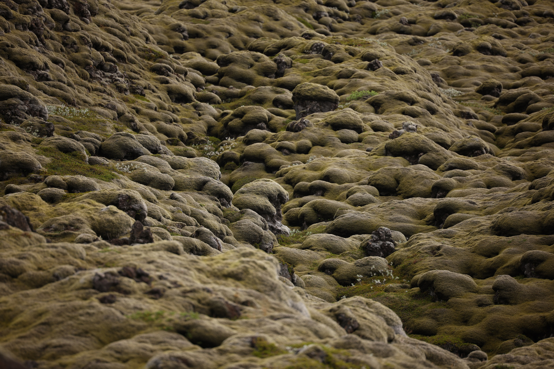
| Moss blankets a lava field created in the 1783-84 eruption of Laki volcano, which led to a famine that killed about a fifth of Iceland’s population and had deadly consequences in Europe and beyond. Photo: Reuters |
Over the last three decades, magma has been produced beneath Iceland at a rate 2 to 3 times what it would have been without the ice loss, according to preliminary modelling results from Parks’ project shared exclusively with Reuters. “More magma is coming in underneath Iceland, and we just don’t need it,” Parks said. “We’ve got enough.”
Scientists first theorised in the 1970s that melting ice might impact volcanic eruptions. But only recently have they begun to understand the scale of the potential threat. Four years ago, volcanologists compiled the first comprehensive global database of volcanoes under ice or within five km (three miles) of it, publishing their findings in the journal Global and Planetary Change. They found that some 245 active or potentially active volcanoes around the world met the criteria, from the Andes to North America’s Cascade Mountains and Alaska, to Russia’s Kamchatka Peninsula and Antarctica.
|
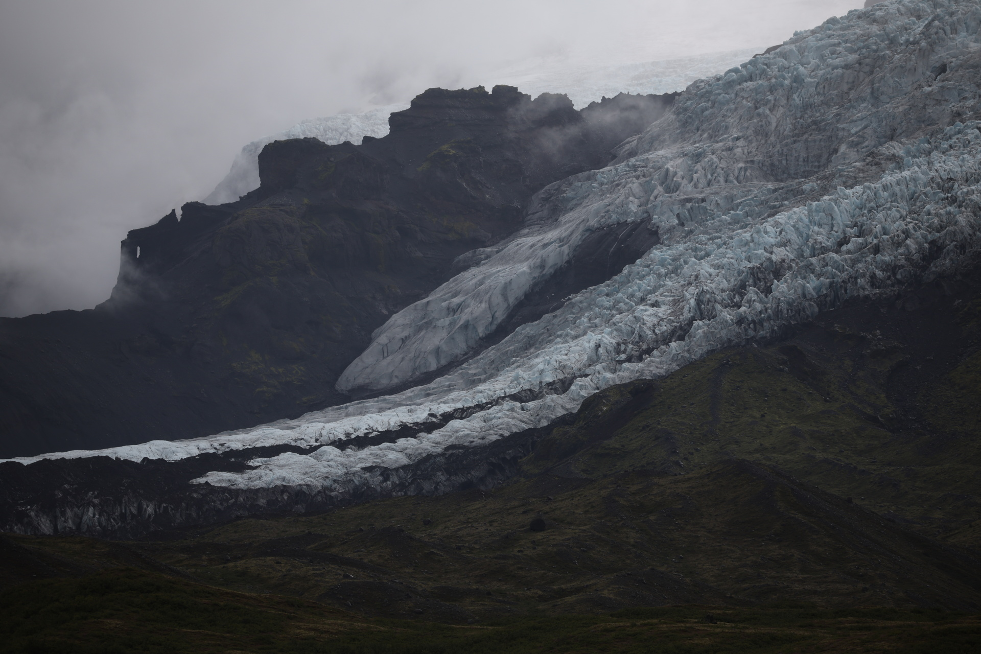
|
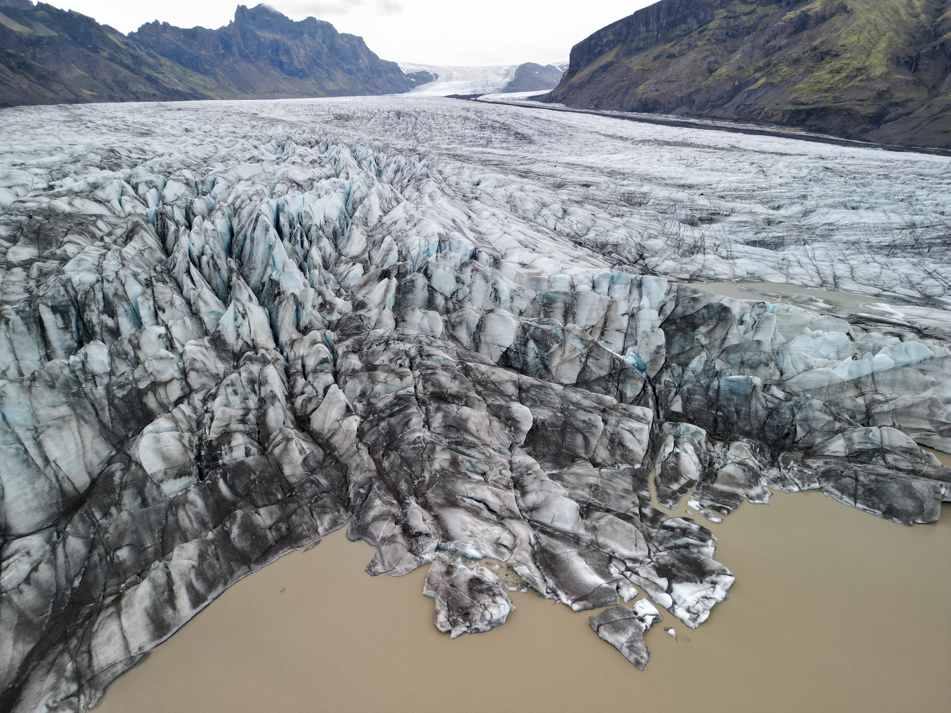
| The glacier Skaftafellsjokull flows out of the Vatnajokull ice cap on Iceland’s south coast. Photo: Reuters |
The same study also found that about 160 million people live within 100 km (62 miles) of at least one of those volcanoes and that 20,000 people are within the immediate vicinity. Numbers like that underscore the threat if glacial melt were to push more volcanoes to pop off, unleashing deadly floods and mud flows and spewing vast clouds of ash and deadly gases into the atmosphere.
A global concern
A 2020 study identified 245 volcanoes within a 5 km radius of a glacier.
The effects wouldn’t end there. Eruptions rich in carbon dioxide, a greenhouse gas, could exacerbate global warming, outlasting the sulphur aerosols in the atmosphere that can cause initial periods of cooling. And the volcanoes now known to sit under the West Antarctic Ice Sheet could help speed ice melt into the ocean, raising sea levels.
|
|
| Oskjuvatn, a large caldera lake created during the 1875 eruption of the Askja volcano, is a focus of research into the interaction between ice and volcanoes. Photo: Reuters |
Evidence suggests that what happened in Iceland after the last Ice Age was duplicated to a lesser extent around the world. Eruptions were between 2 and 6 times higher globally between 12,000 and 7,000 years ago owing to more frequent eruptions in areas that were losing their ice cover, according to a 2009 study in the journal Earth and Planetary Science Letters.
A violent history
Iceland is uniquely primed for frequent volcanic eruptions because of its location at the juncture of two tectonic plates that are pulling apart over an upwelling of anomalously hot material in the Earth’s mantle. Many smaller eruptions have little impact beyond their immediate vicinity, though they are still able to put on spectacular shows. Others can have lethal effects far beyond Iceland.
When Laki, southwest of Askja, erupted in 1783-84, the fluorine it expelled contaminated the island’s plants and water sources, killing more than half of Iceland’s livestock. This agricultural collapse led to a famine that killed around a fifth of the island’s human population, while the resulting haze of sulphurous fog that later reached Europe may have contributed to the deaths of thousands more people. And as far away as Africa and Asia, the eruption’s effects weakened monsoons, initiating more famines.
|
|
| Scientists worry about the risk to visitors to Viti crater and the Askja complex in summer if the volcano were to erupt. Photo: Reuters |
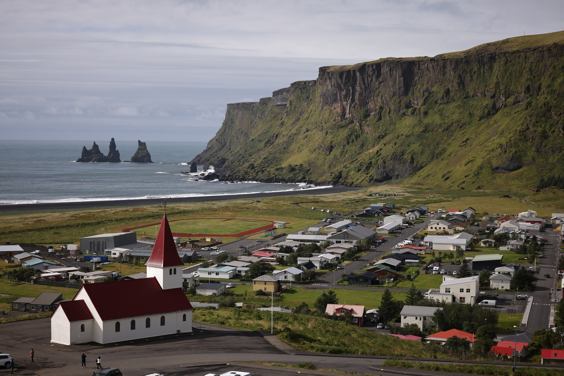
Near the southern coast under a small ice cap lies Katla, considered one of the world’s most dangerous volcanoes under ice. Katla has racked up more than 20 eruptions since the Middle Ages, averaging one every 60 years, and it is past due for another, having last erupted in 1918. During that eruption, heat pouring from Katla’s caldera rapidly melted the ice atop the volcano, releasing a torrent of water greater than the combined discharges of the Amazon, Mississippi, and Yangtze rivers at its peak. And, like Laki, Katla has explosive potential.
“The time for Katla to erupt is coming close ... It is high time for European governments and airline authorities all over Europe and the world to start planning for the eventual Katla eruption," then-Icelandic President Olafur Ragnar Grimsson told BBC News in 2010, following the eruption of Eyjafjallajökull. The ash cloud from that eruption caused €1.3 billion (US$1.4 billion) in losses from cancelled flights during a six-day European airspace ban, making it the world’s costliest eruption in the last century.
|
|
| Tourists sometimes take a plunge in Viti crater’s lake despite warnings of acidic water and rockfall. Photo: Reuters |
The Icelandic government has emergency plans in place for a Katla-style eruption and works with local police districts to create near-term risk assessments for other volcanoes.
But the government has also tapped its fiery foundation to its benefit, using it to heat homes and businesses and draw big-spending tourists to rejuvenating geothermal baths. After the Eyjafjallajökull eruption, the Icelandic government made volcanoes a pillar of a now multibillion-dollar tourism industry. Souvenir shops in the capital, Reykjavik, sell lava rocks from a recent eruption on the Reykjanes Peninsula for 2,000 Icelandic krona (US$14) apiece.
“Watching your friends disappear”
Like many Icelanders, 29-year-old Iris Ragnarsdottir Pedersen and her father, 62-year-old Ragnar Frank Kristjansson, have an intimate knowledge of the extremes of their land of ice and fire. Along the south coast in Svinafell, Ragnarsdottir Pedersen, a mountain guide, lives with her husband and their Icelandic sheepdog, Blika. Her father, a retired national park manager, has a small turf-roofed summer house next door. Towering over them is a large cliff, beyond which lies Vatnajokull ice cap and, under it, the volcano Oraefajokull.
|
|
| Scientists with the University of Geneva prepare to set out on a scientific mission on the dangerous waters of the Oskjuvatn caldera lake. Photo: Reuters |
After Oraefajokull erupted in 1362, sailors reported seaborne pumice floating “in such masses that ships could hardly make their way through it.”
Father and daughter both recall joining fellow Icelanders over the years to marvel at the glowing fountains and rivers of lava produced by eruptions. They also are familiar with the impact of climate change.
For 25 years, Kristjansson has volunteered as a glacier monitor with the Icelandic Glaciological Society, tracking the retreat of two glaciers that flow out of the Vatnajokull ice cap, the nation’s largest. Every autumn, he treks for hours to one of the glaciers, Skeidararjokull, to take measurements that he sends to the Icelandic Meteorological Office. “It's a lonely walk toward the glacier — 15 km in the black sand,” he said.
|
|
| Pumice and other lava rocks ejected during past eruptions cover the ground around Askja volcano. Photo: Reuters |
Kristjansson used to be able to stride right up to the edge of Skeidararjokull. But as it has rapidly shrunk over the past decade, a lake has formed at the foot of the glacier, blocking his way. He now has to use special binoculars to measure the distance. This year, he said, one point along the glacier’s edge showed a retreat of 300 metres (984 feet), which is the greatest he has recorded.
Ragnarsdottir Pedersen has witnessed the retreat from year to year on treks to the glaciers with her father and by simply looking out her windows. “It’s just devastating to see,” she said. “I’ve sometimes said to people, ‘It’s like watching your friends disappear.’ ”
|
|
| Freysteinn Sigmundsson, a geophysicist at the University of Iceland, is part of the research team monitoring recent changes at Askja. Photo: Reuters |
As a child, she knew Oraefajokull lurked under the Vatnajokull ice cap. But it only became a concern when the volcano started rumbling in 2017, just as she and her husband began planning to build their home near it. When she felt the earthquakes and caught the smell of sulphur from the rivers, she said, “You’re like, ‘Oh yeah, we actually have this powerful, quite dangerous volcano right above our home.’ ”
Ultimately, she and her husband weren’t concerned enough to cancel the move, having faith that scientists would closely monitor the volcano for any danger. “People have lived in Svinafell since the settlement of Iceland,” she said.
|
|
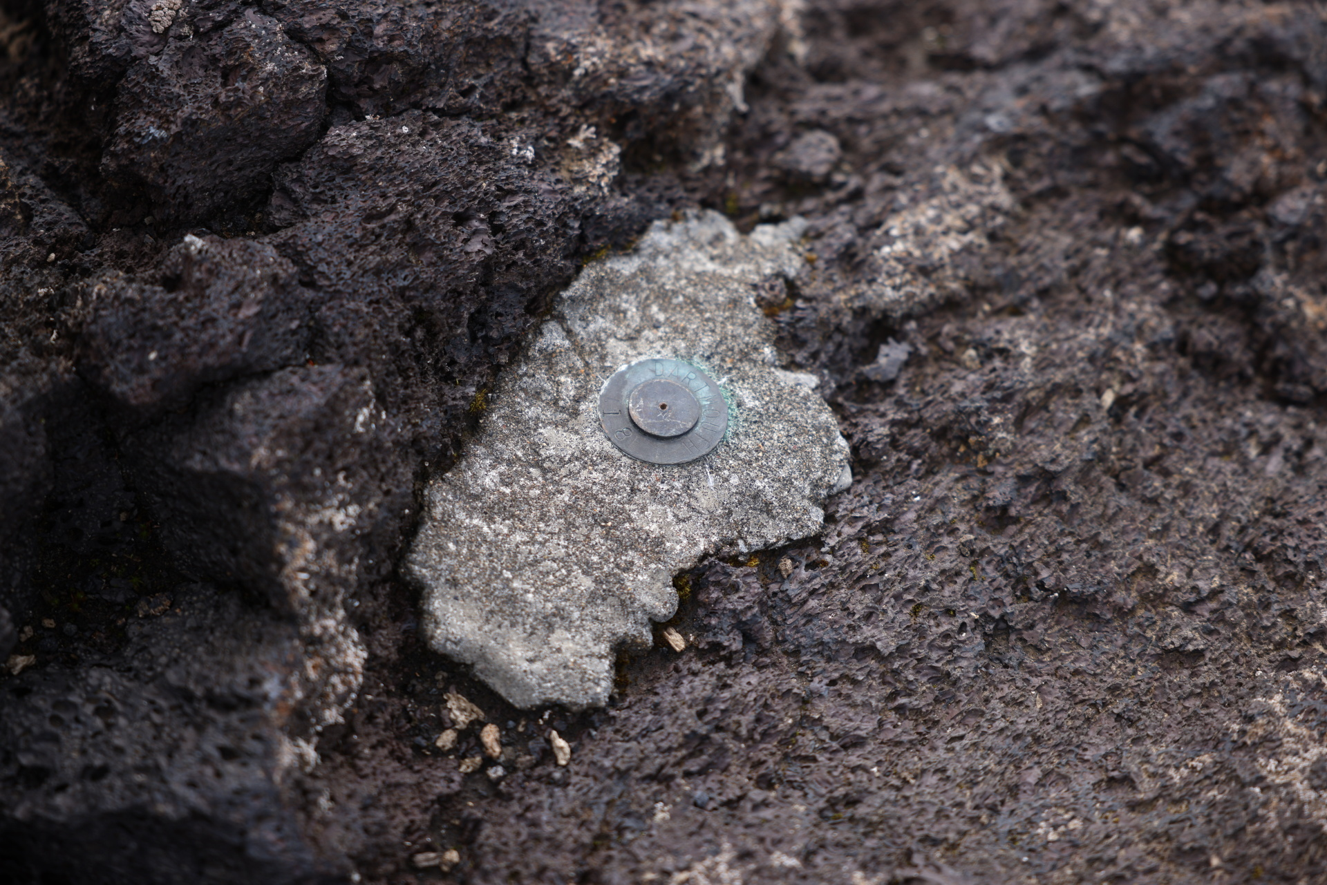
| Scientists use fixed metal survey markers like this one to measure changes in Askja’s position over time. Photo: Reuters |
A scientific mecca
Oraefajokull is one of six active volcanoes covered by the Vatnajokull ice cap. As Vatnajokull has thinned and retreated, some of the volcanoes beneath it, as well as nearby Askja, have become agitated. Oraefajokull has calmed since its 2017 awakening. Grimsvotn and Bardarbunga, two volcanoes under the ice cap that are being assessed in Parks’ project, have together notched five eruptions in the past 30 years, compared with just one under the ice cap in the preceding 40 years.
Parks and her scientific colleagues said it’s too early to conclude that the increased activity under Vatnajokull is linked to rapid loss of ice cover. Other scientists have established that clusters of eruptions can occur in natural cycles under the ice cap. But to determine whether climate change may also be playing a part, they will have to collect more data on ice retreat and magma generation and feed it into complex computer models.
|
|
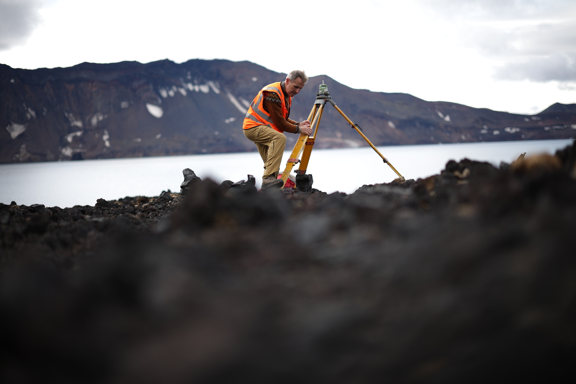
| Freysteinn Sigmundsson, the University of Iceland geophysicist, uses a surveying tripod to track changes in Askja's position and ground uplift. Photo: Reuters |
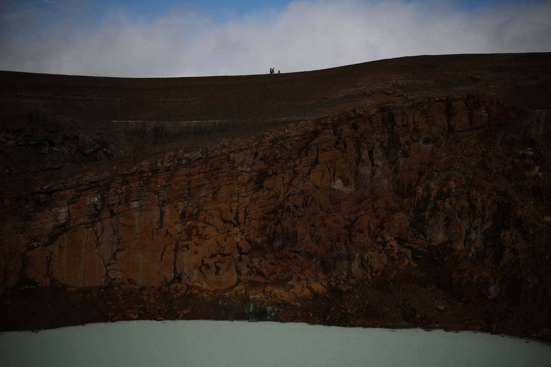
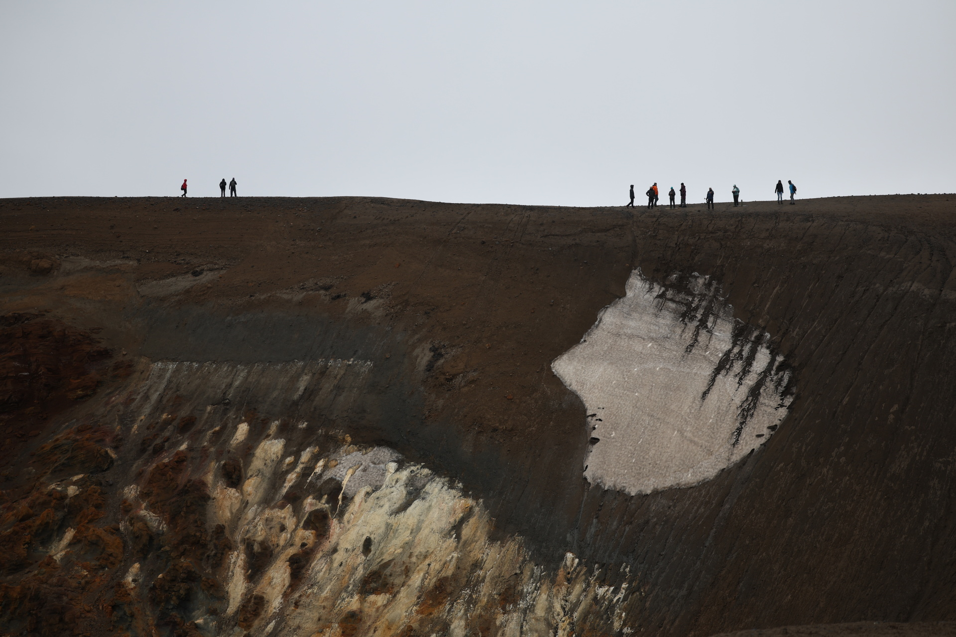
Because of its continuing unrest, Askja is the main draw for scientists, who flock to its enormous calderas when Iceland’s brief summer allows for field research. Like most of Iceland’s volcanoes, Askja does not conform to the stereotypical cone shape of volcanoes such as Japan’s iconic Mount Fuji. Instead, fissures snake across a sprawling Mars-like landscape carpeted with lava rocks and pockmarked with craters from past eruptions.
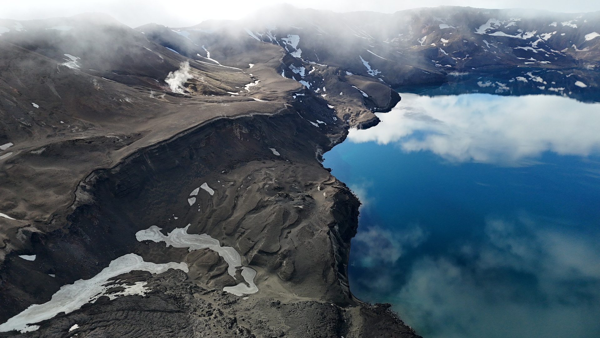
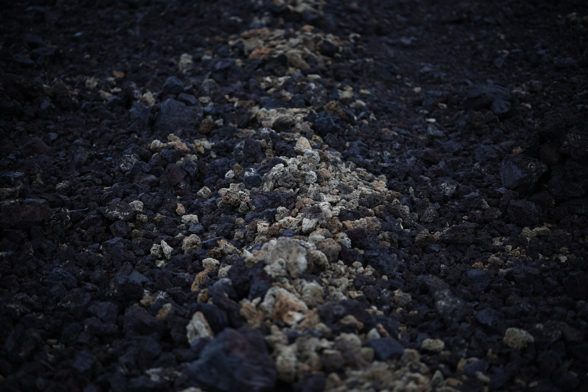
To reach the centrepiece of the Askja system, an 11-square-km (four sq miles) caldera lake called Oskjuvatn, scientists journey hours across the highlands in Super Jeeps and Land Rovers balanced on 35-inch tires. Oskjuvatn was formed in an explosive 1875 eruption that shot out huge volumes of airy pumice, much of it still covering the area around Askja, with fist-sized chunks tossed about by strong winds.
|
|
| Warm, acidic water laps the rock-strewn shore of Viti’s crater lake. Photo: Reuters |
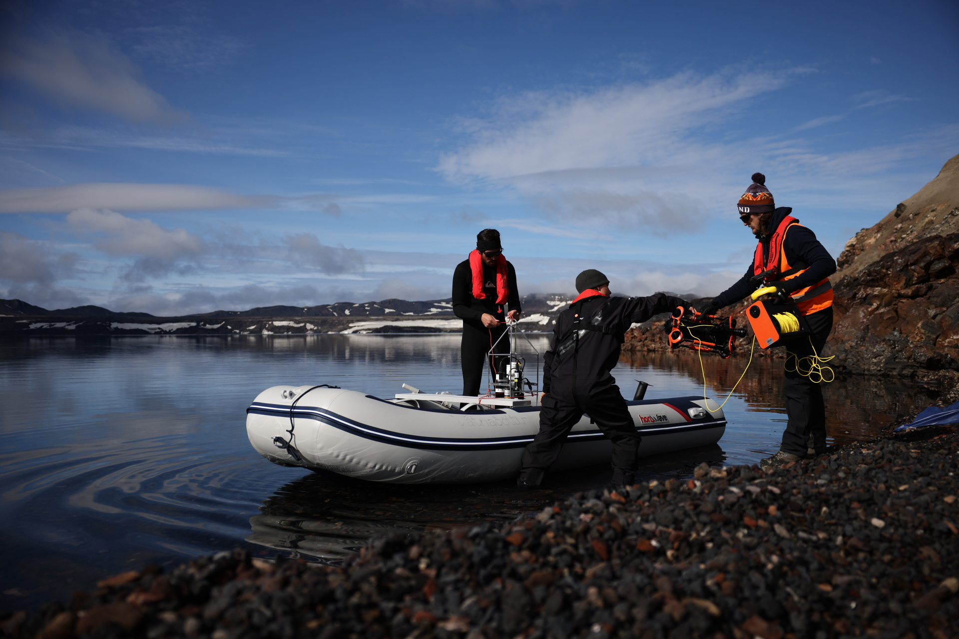
Above the magma reservoir near the western side of the lake is where Askja has been inflating fastest, a lure for researchers. On a visit in August, Reuters encountered a team of three scientists from the University of Geneva at the lake’s edge, loading equipment into an inflatable dinghy. Their aim: to measure carbon dioxide concentrations in the lake and collect water samples from its deepest points.
The data is not easy to get. The numbingly cold and often tempestuous waters are dangerous. Landslides on the caldera’s steep scarp can launch tsunamis big enough to swamp neighbouring Viti crater. In 1907, two German scientists set off onto the lake and were never seen again. The Geneva team’s boat would be the first on the lake in nearly a decade. The University of Geneva researchers suited up in thick thermal gear, just in case.
The great weight of glaciers places downward pressure on the Earth’s crust and mantle, in effect dampening upward force from magma chambers beneath volcanoes.
As the ice cover melts, this downward pressure eases, enabling more rock in the mantle to melt and form magma.
|
|
| Kotarjokull glacier, part of Vatnajokull ice cap, in southern Iceland. Photo: Reuters |
The rebound of the crust can also affect stress fields in the Earth, altering the movement of magma and creating new fractures underneath a volcano. Magma reservoirs can become unstable and move closer to eruption.
As magma pushes upward, it can cause the ground to expand and trigger swarms of small earthquakes. When the pressure is high enough, an eruption can burst through the surface.
One of them, geologist Nicolas Oestreicher, said the work was important given both Askja’s explosive capabilities and the increased activity around the lake. “If it’s a big explosion, then it’s really dangerous for the people around here, the tourists,” Oestreicher said.
His team, which later returned safely from their boat trip, was one of several from Iceland and abroad that day racing to figure out what was going on at Askja. University of Iceland geophysicist Freysteinn Sigmundsson, co-head with Parks of the government-funded project, was there, too. “Today may be the richest day in all of Askja’s history in terms of the number of scientists here,” he said.
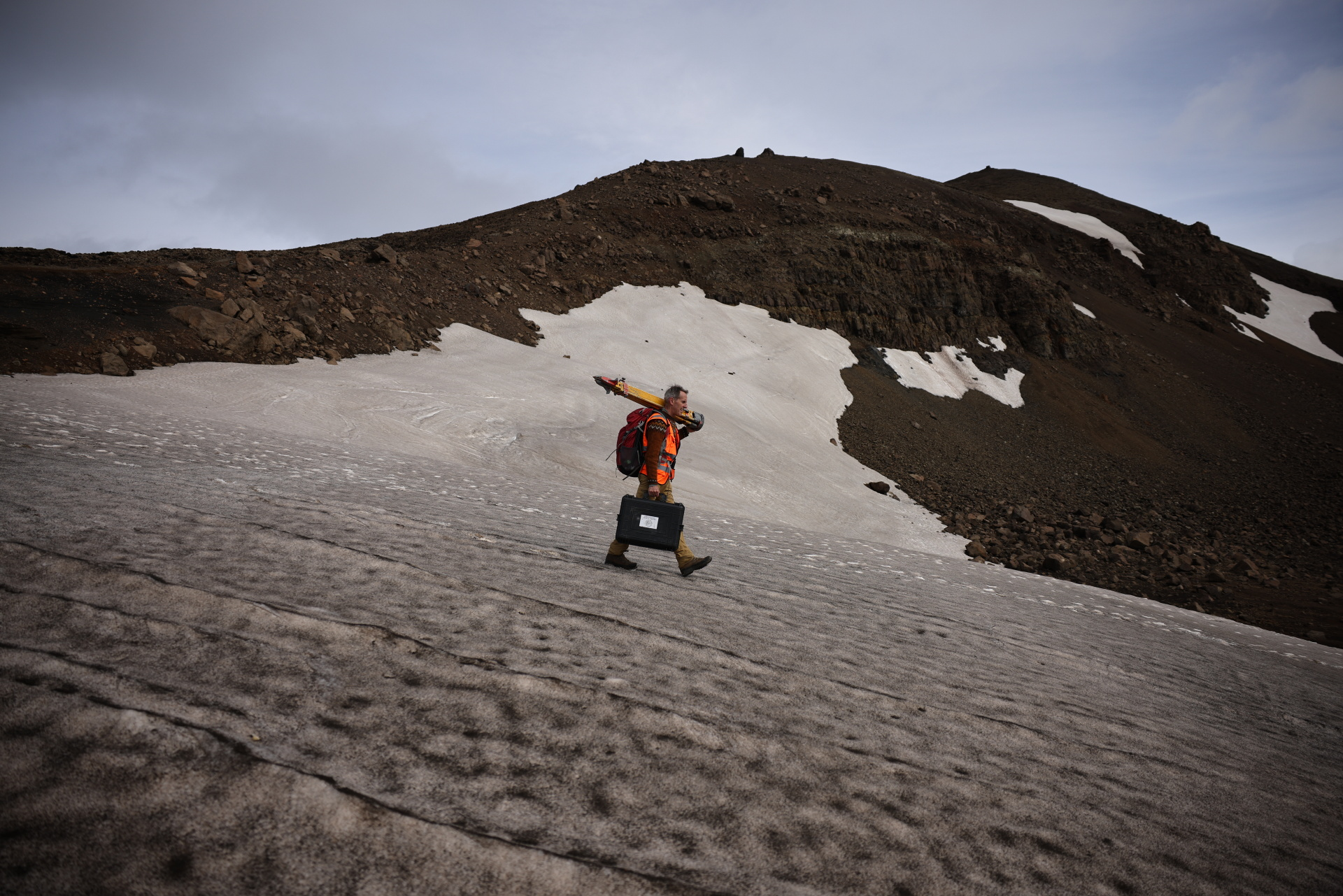
Sigmundsson has been coming to the volcano almost every year since 1990 and he knows the terrain well. Shouldering a surveying tripod, he clambered with sure-footed expertise across beds of jagged, crunchy lava, searching for round metal markers that scientists anchored in the area in the 1960s and 1970s. These would tell him where to set up his equipment to check how much Askja had grown or shifted over the past year.
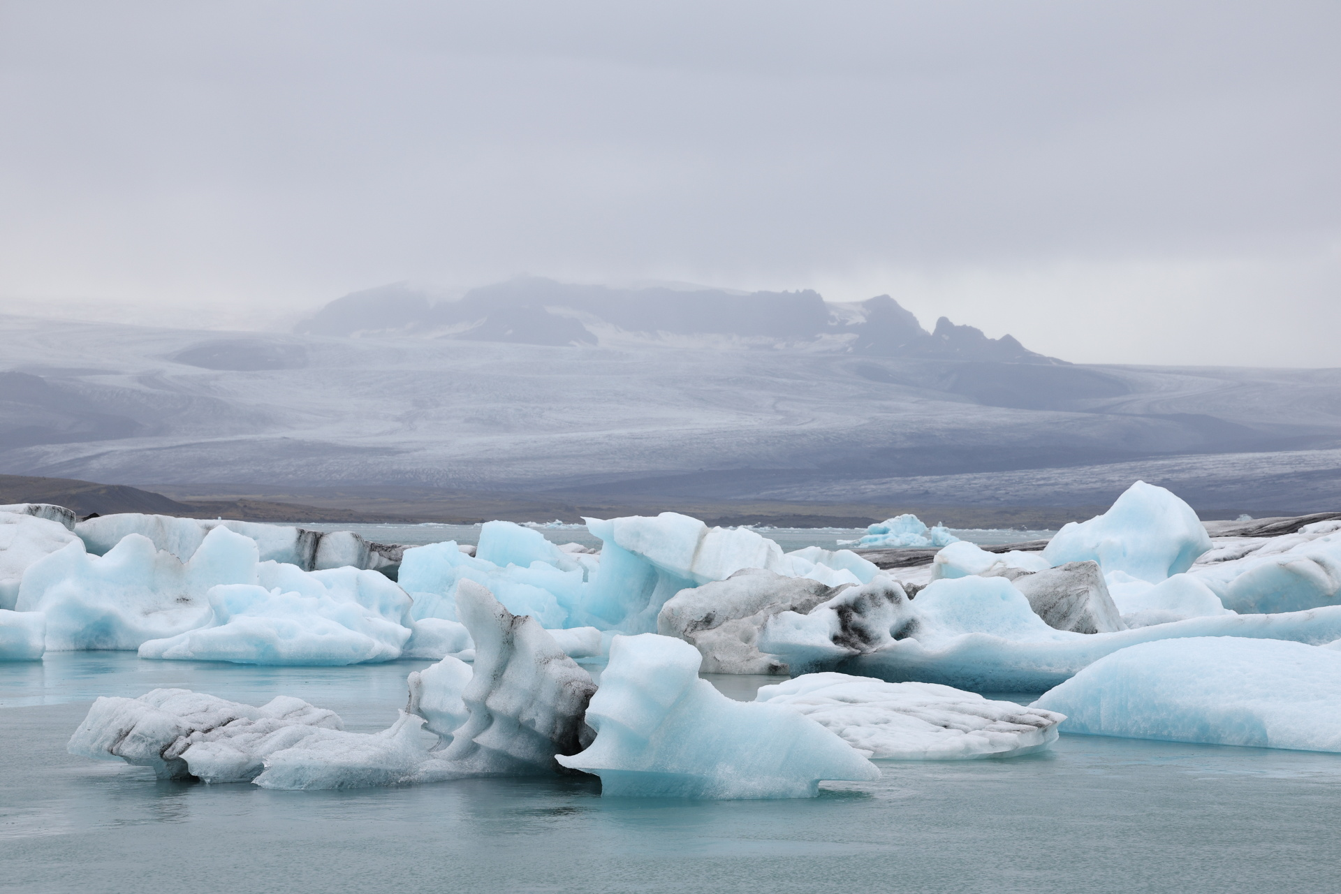
|
|
| Jokulsarlon, a lagoon formed at the edge of Breidamerkurjokull glacier, which flows from the Vatnajokull ice cap to the sea. Photo: Reuters |
The measurements Sigmundsson and his colleagues took in August showed 12 cm (five inches) of uplift at Askja since the previous year, confirming that the volcano was still in a state of unrest and could erupt at any time.
From the Andes to Antarctica
Regardless of what they ultimately find, the interplay between volcanoes and ice will remain a chief worry among volcanologists. The most deadly eruption in the last 100 years was that of Nevado del Ruiz in the Colombian Andes in 1985. Some 23,000 people were killed after a superheated amalgam of ash, lava fragments and gases known as a pyroclastic flow melted snow and ice near the volcano’s summit, sending massive rivers of mud and debris rushing down the volcano’s flanks.
“Any eruption where there is a possibility of (snow or ice) interacting with the hot stuff adds to the elements of danger,” said Ben Edwards, a volcanologist at Dickinson College in Pennsylvania and lead author of the 2020 study that produced the database of ice-clad volcanoes.
Edwards and his fellow researchers drew up a list of the world’s most dangerous volcanoes that lie under glaciers, based on the volume of ice on or near each one, the frequency of past eruptions, and the population living within 30 km (19 miles). Seven of the top 10, they found, are in the Andes. The most dangerous is Villarrica in Chile, with more than 35,000 people living in its shadow. Edwards is in the middle of a five-year study seeking to understand how Villarrica responded to glacial retreat at the end of the last Ice Age.
The small number of studies to date of the interaction between retreating ice and volcanoes in other parts of the world, scientists said, mean the research underway in Iceland will help create a template for what could happen elsewhere. It’s not a perfect comparison: The underlying plate tectonics in Iceland differ from those in the Andes. Magma reservoirs also lie much deeper in the crust in the Andes than in Iceland, Edwards said.
“We don’t have a very good physical understanding of all the processes that control melting (of rock into magma) deeper in the mantle,” said David Pyle, a volcanologist at the University of Oxford who studies Chilean volcanoes. “Whereas in Iceland, the conceptual model is much better developed because in a way it’s geologically simpler.”
Antarctica, where both ice and volcanoes are abundant, has become an area of concern in recent years. While a handful of volcanoes were known to reside under the vast West Antarctic Ice Sheet, in 2017 scientists reported detecting another 91 possible volcanoes hidden there.
How many of them are active or have the potential to awaken is difficult to ascertain. “There are probably two or three which are certainly active. But there may be as many as 100 or 150,” said John Smellie, a former senior volcanologist with the British Antarctic Survey who has completed 27 field seasons on the continent and won two Polar Medals from the British royals.
If climate change kicks off a new era of eruptions in the coming decades, Smellie said, it would hasten the already rapid loss of the continent’s ice cover due to climate change, adding to rising sea levels and swamping the world’s big coastal cities. Antarctica is shedding more than 150 billion metric tons of ice a year, according to satellite measurements, and scientists believe that as oceans continue to warm, the West Antarctic Ice Sheet is fast approaching a tipping point beyond which the melt cannot be stopped.
“If an eruption adds even a small amount to global sea level, it will exacerbate effects already happening due to climate change,” Smellie said.
Under the worst-case scenario, rapid melting of the West Antarctic Ice Sheet would ease the pressure on buried volcanoes, triggering eruptions. This in turn would speed up ice loss, awakening even more volcanoes that melt more ice, and so on, leading to global catastrophe. However, Smellie said, that is unlikely to happen because thousands of nearly simultaneous eruptions would be needed to melt even a small proportion of the ice sheet.
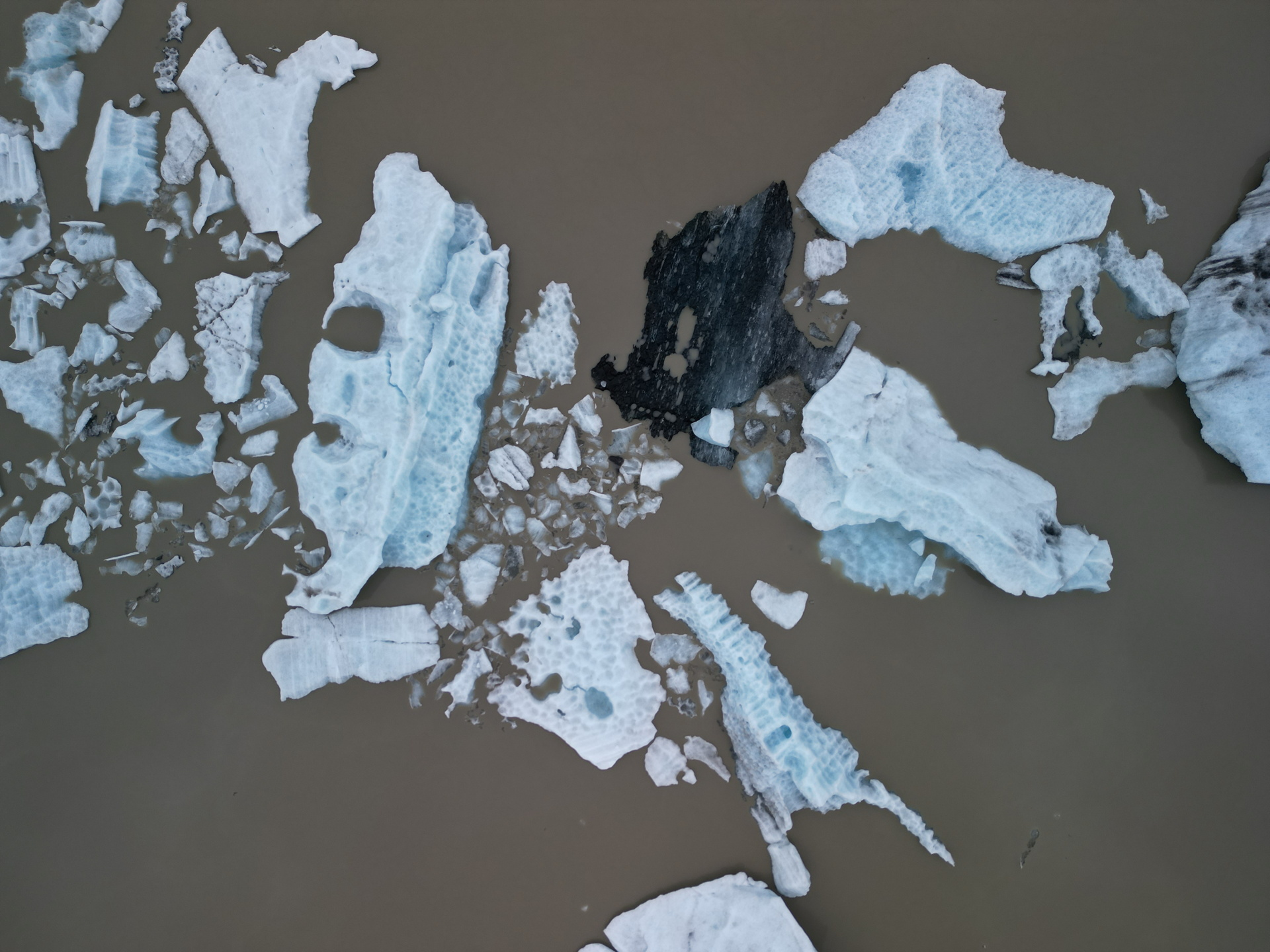
|
|
| Chunks of ice float in the lagoon of Skaftafellsjokull, a glacier that flows out of the Vatnajokull ice cap. Photo: Reuters |
In the danger zone
Few people make their home near Askja. The closest village lies about 60 km (37 miles) away. But some 13,000 people visit the volcano during the summer months, when Askja is more accessible, according to data from the national park authority. Often, tourists climb down into Viti crater to swim in the Instagram-worthy lake, despite signs that warn them about acidic water, which can irritate skin, and falling rock.
After a week of field work at and around Askja last August, the volcanologists gathered park rangers and local police and lodging staff in a nearby ranger hut one evening for a safety briefing on the state of the volcano.
Parks hovered over her laptop displaying a series of charts and graphs on her most recent findings that showed Askja was still inflating. Sigmundsson, standing in the doorway, explained to the rangers and police that predicting eruptions is an imprecise science; they may not necessarily have weeks of seismic activity as a warning of an imminent eruption. “The time scale can be quite short,” he said. “Hours, maybe … You would want to have a plan if something happens to quickly evacuate the caldera.”
One of the greatest risks to tourists is a phreatic explosion — a blast of hot steam, ash and rocks that comes with little warning. That’s what formed Viti crater nearly 150 years ago. In 2019, a phreatic explosion at New Zealand’s White Island volcano killed 22 people who were visiting the island at the time.
At Sigmundsson’s words, the room fell quiet. One of the police officers then piped up with a plan: “We just have to hope that it blows up in the middle of the winter.”

They expressed interest in adopting lessons from Vietnam’s growth experience during their meetings with Prime Minister Pham Minh Chinh in Russia

Traders are gradually abandoning locally-made products to opt for Chinese alternatives

Brown dwarfs are neither a star nor a planet, but something in between
1 week ago
Scientists are racing to find out whether the rapid retreat of glaciers could drive a surge in eruptions
4 hours ago
While delegates in suits gathered to hash out plans for protecting Earth's biodiversity at a UN summit, activists and ordinary citizens in T-shirts and feathered headgear celebrated nature's bounty at a colorful side-event in the Colombian city of Cali
2 days ago
Current climate policies will result in global warming of more than 3 degrees Celsius (5.4 degrees Fahrenheit) by the end of the century
2 days ago
Before the Zaha Hadid-designed plaza, before the luxury high rises, before the South Korean neighbourhood hosted fashion week, there was a pastor handing out rice to poor pensioners in Seoul's Dongdaemun district
2 days ago
Vietnam currently ranks second in Southeast Asia and third in Asia for per capita alcohol consumption


Vietnam is aiming to build a sustainable cruise tourism network

He paid a six-day visit to North Korea to conduct the fifth Vietnam - North Korea deputy foreign minister-level policy exchange

Vietnam currently ranks second in Southeast Asia and third in Asia for per capita alcohol consumption
Scientists are racing to find out whether the rapid retreat of glaciers could drive a surge in eruptions

The storm is forecast to make landfall in central Vietnam on Sunday afternoon

The storm was moving west-northeast at a speed of about 15kph.

Good morning from Vietnam!

The platform has yet to get a license to operate in Vietnam

In late 2016, Tam and Thoai married, and their educational dream felt more achievable than ever

She radiates positivity despite having to juggle a doctoral program, two kids, and management duties