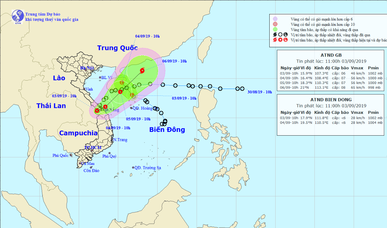
Heavy downpours are expected to dampen central Vietnamese provinces over the next days due to the presence of two tropical depressions at a time.
The first tropical depression, which entered the East Vietnam Sea last weekend, made landfall on the coast between the central provinces of Quang Tri and Thua Thien-Hue on early Tuesday morning, according to the National Center for Hydro-meteorological Forecasting.
Average wind speed was recorded at 40 to 50km per hour and gusts at up to 75km an hour.
In the next 24 hours, the low-pressure system is expected to travel northeast and head back to the sea.
It will be located in the maritime area off north-central Vietnam on Wednesday morning, with wind speed increasing to between 40 and 60km per hour.
The tropical depression will continue tracking northeastward in the next 24 to 48 hours and may strengthen into a storm.
Meanwhile, the second tropical depression was located about 140 kilometers east of Vietnam's Hoang Sa (Paracel) archipelago as of 4:00 am on Tuesday.
However, it weakened into a low-pressure zone at 10:00 am the same day and was situated 100 kilometers north of Hoang Sa, unleashing winds at below 40km per hour, as of 11:00 am.
Under the influence of the two low-pressure systems, heavy downpours will dampen north-central and central provinces, as well as the Central Highlands from September 3 to 5.
Medium to heavy rainfall is also in the forecast in southern Vietnam during this period.
The weather pattern also poses high risks of inundation along local rivers as well as flashfloods and landslides in mountainous areas across north-central Vietnam.
Like us on Facebook or follow us on Twitter to get the latest news about Vietnam!


